| Name | Jurastraße (name)
|
| Type | highway:service |
| Last Updated | 2018-12-05 14:51 |
| Admin Level | 15 |
| Rank | Minory Street / Path |
| Importance | 0.075 (estimated) |
| Coverage | Point |
| Centre Point | 48.8053883,10.1940761 |
| OSM | way 104199509 |
| Computed Postcode | 73432 |
| Address Tags | |
| Extra Tags | paved (surface)
|
| Local name | Type | OSM | Address rank | Admin level | Distance | |
| Jurastraße | highway:service | way 104199509 | 27 | 0 | details > | |
| Ebnat | place:suburb | node 32518294 | 20 | 0 | details > | |
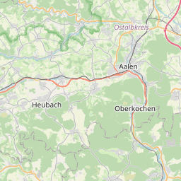
| Aalen | place:town | relation 915486 | 16 | 8 | 0 | details > |
| Hohenberg | place:hamlet | node 387491231 | 16 | 0 | details > | |
| Niesitz | place:hamlet | node 289176518 | 16 | 0 | details > | |
| Geiselwang | place:hamlet | node 262085707 | 16 | 0 | details > | |
| Brünstholz | place:hamlet | node 1515679703 | 16 | 0 | details > | |
| Glashütte | place:hamlet | node 333757864 | 16 | 0 | details > | |
| Brastelburg | place:village | node 302707262 | 16 | 0 | details > | |
| Affalterwang | place:hamlet | node 387493373 | 16 | 0 | details > | |
| Diepertsbuch | place:hamlet | node 428630279 | 16 | 0 | details > | |
| Verwaltungsgemeinschaft Aalen | boundary:administrative | relation 2952513 | 14 | 7 | 0 | details > |
| Ostalbkreis | place:county | relation 62708 | 12 | 6 | 0 | details > |
| Regierungsbezirk Stuttgart | boundary:administrative | relation 22041 | 10 | 5 | 0 | details > |
| Baden-Württemberg | place:state | relation 62611 | 8 | 4 | ~1 m | details > |
| 73432 | place:postcode | 5 | 0 | |||
| 73432 | place:postcode | relation 1101580 | 5 | 0 | details > | |
| Deutschland | place:country | relation 51477 | 4 | 2 | ~3 m | details > |
| de | place:country_code | 4 | 0 | |||
Parent Of | ||||||
Building | ||||||
| No Name | building:yes | way 256959638 | 30 | ~14 m | details > | |