| Name | Brettgabel (name)
|
| Type | highway:path |
| Last Updated | 2018-12-05 13:05 |
| Admin Level | 15 |
| Rank | Minory Street / Path |
| Importance | 0.075 (estimated) |
| Coverage | Point |
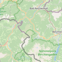
| Centre Point | 47.5892113,13.032309 |
| OSM | way 111377013 |
| Computed Postcode | 83471 |
| Address Tags | |
| Extra Tags | demanding_mountain_hiking (sac_scale)
intermediate (trail_visibility)
|
| Local name | Type | OSM | Address rank | Admin level | Distance | |
| Brettgabel | highway:path | way 111377013 | 27 | 0 | details > | |
| Mitterkaser-Alm | place:isolated_dwelling | node 2447646605 | 20 | 0 | details > | |
| Schönau am Königssee | place:village | relation 941800 | 16 | 8 | 0 | details > |
| Schwöb | place:village | node 1878094490 | 16 | 0 | details > | |
| Landkreis Berchtesgadener Land | boundary:administrative | relation 62712 | 12 | 6 | 0 | details > |
| Obb | boundary:administrative | relation 2145274 | 10 | 5 | ~1 m | details > |
| Bayern | place:state | relation 2145268 | 8 | 4 | ~2 m | details > |
| 83471 | place:postcode | 5 | 0 | |||
| 83471 | place:postcode | relation 1114643 | 5 | 0 | details > | |
| Deutschland | place:country | relation 51477 | 4 | 2 | ~5 m | details > |
| de | place:country_code | 4 | 0 | |||
Parent Of | ||||||
Boundary_stone | ||||||
| 134/10 | historic:boundary_stone | node 3182959153 | 30 | ~1.5 km | details > | |
| 134/11 | historic:boundary_stone | node 3182959141 | 30 | ~1.6 km | details > | |
| 134/9 | historic:boundary_stone | node 3182959119 | 30 | ~1.6 km | details > | |
| 135 | historic:boundary_stone | node 3182959905 | 30 | ~1.6 km | details > | |
| 136 | historic:boundary_stone | node 2498398544 | 30 | ~1.8 km | details > | |
| 136/1 | historic:boundary_stone | node 323820368 | 30 | ~1.9 km | details > | |
| 136/2 | historic:boundary_stone | node 2498398543 | 30 | ~2 km | details > | |
| 136/3 | historic:boundary_stone | node 3182959871 | 30 | ~2 km | details > | |
| 136/5 | historic:boundary_stone | node 3182959916 | 30 | ~2.2 km | details > | |
| 136/6 | historic:boundary_stone | node 3182959912 | 30 | ~2.3 km | details > | |
| 137 | historic:boundary_stone | node 323614301 | 30 | ~2.3 km | details > | |
| 137/1 | historic:boundary_stone | node 3182959150 | 30 | ~2.4 km | details > | |
| 137/10 | historic:boundary_stone | node 323278071 | 30 | ~3.1 km | details > | |
| 137/11 | historic:boundary_stone | node 323435710 | 30 | ~3.2 km | details > | |
| 137/12 | historic:boundary_stone | node 2498398540 | 30 | ~3.3 km | details > | |
| 137/13 | historic:boundary_stone | node 323454089 | 30 | ~3.4 km | details > | |
| 137/14 | historic:boundary_stone | node 323664442 | 30 | ~3.4 km | details > | |
| 137/2 | historic:boundary_stone | node 324002536 | 30 | ~2.5 km | details > | |
| 137/3 | historic:boundary_stone | node 323734369 | 30 | ~2.5 km | details > | |
| 137/4 | historic:boundary_stone | node 3182959902 | 30 | ~2.6 km | details > | |
| 137/6 | historic:boundary_stone | node 323425510 | 30 | ~2.8 km | details > | |
| 137/8 | historic:boundary_stone | node 324093444 | 30 | ~2.9 km | details > | |
| 137/9 | historic:boundary_stone | node 323986289 | 30 | ~3 km | details > | |
| 138 | historic:boundary_stone | node 324118805 | 30 | ~3.6 km | details > | |
| 138/1 | historic:boundary_stone | node 323480972 | 30 | ~3.6 km | details > | |
| 138/2 | historic:boundary_stone | node 324070655 | 30 | ~3.6 km | details > | |
| 138/3 | historic:boundary_stone | node 3182959889 | 30 | ~3.7 km | details > | |
| 138/5 | historic:boundary_stone | node 3182959880 | 30 | ~3.8 km | details > | |
| 138/6 | historic:boundary_stone | node 3182959130 | 30 | ~4 km | details > | |
| 138/7 | historic:boundary_stone | node 3182959128 | 30 | ~4 km | details > | |
| 138/8 | historic:boundary_stone | node 3182959899 | 30 | ~4 km | details > | |
| 138/9 | historic:boundary_stone | node 2498398538 | 30 | ~4.1 km | details > | |
Scree | ||||||
| Bockskehle | natural:scree | way 128050143 | 30 | ~3.3 km | details > | |
| Ruckkar | natural:scree | way 128050158 | 30 | ~2.5 km | details > | |
Information | ||||||
| Jägerkreuz | tourism:information | node 2014151669 | 30 | ~1.1 km | details > | |
| Schneibstein | tourism:information | node 1868469579 | 30 | ~3.6 km | details > | |
| No Name | tourism:information | node 5876975812 | 30 | ~2 km | details > | |
| No Name | tourism:information | node 1868469580 | 30 | ~1.7 km | details > | |
Building | ||||||
| Krautkaseralm | building:yes | way 440457350 | 30 | ~589 m | details > | |
| No Name | building:yes | way 127978111 | 30 | ~2.1 km | details > | |
Cliff | ||||||
| Königstalwand | natural:cliff | way 91752724 | 30 | ~3.5 km | details > | |
| Teufelsgemäuer | natural:cliff | way 128050161 | 30 | ~2.3 km | details > | |
Restaurant | ||||||
| Schneibsteinhaus | amenity:restaurant | way 127978113 | 30 | ~2 km | details > | |
Alpine_hut | ||||||
| Schneibsteinhaus | tourism:alpine_hut | way 127978113 | 30 | ~2 km | details > | |
Drag_lift | ||||||
| No Name | aerialway:drag_lift | way 23640331 | 30 | ~995 m | details > | |
Viewpoint | ||||||
| No Name | tourism:viewpoint | node 1868477926 | 30 | ~2.8 km | details > | |
Bench | ||||||
| No Name | amenity:bench | node 1869437847 | 30 | ~1.9 km | details > | |