| Name | |
| Type | highway:unclassified |
| Last Updated | 2018-12-04 07:49 |
| Admin Level | 15 |
| Rank | Street / Major Landmark |
| Importance | 0.1 (estimated) |
| Coverage | Point |
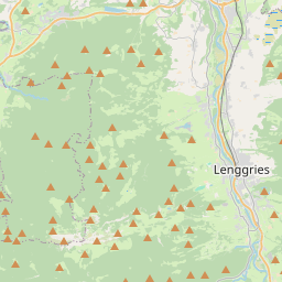
| Centre Point | 47.7006891,11.5798535 |
| OSM | way 112047333 |
| Computed Postcode | 83674 |
| Address Tags | |
| Extra Tags | hiking (sac_scale)
grade2 (tracktype)
|
| Local name | Type | OSM | Address rank | Admin level | Distance | |
| No Name | highway:unclassified | way 112047333 | 26 | 0 | details > | |
| Gilgenhöfe | place:isolated_dwelling | node 5135518571 | 20 | 0 | details > | |
| Beindlhof | place:isolated_dwelling | node 5599319075 | 20 | 0 | details > | |
| Gaißach | place:village | relation 935234 | 16 | 8 | 0 | details > |
| Untermberg | place:hamlet | node 4440109293 | 16 | 0 | details > | |
| Rain | place:hamlet | node 4440168590 | 16 | 0 | details > | |
| Lenggries | place:town | relation 935242 | 16 | 8 | 0 | details > |
| Obergries | place:village | node 4440168593 | 16 | 0 | details > | |
| Obersteinbach | place:hamlet | node 4440164492 | 16 | 0 | details > | |
| Untersteinbach | place:hamlet | node 4440097792 | 16 | 0 | details > | |
| Grundern | place:hamlet | node 2028063221 | 16 | 0 | details > | |
| Landkreis Bad Tölz-Wolfratshausen | boundary:administrative | relation 62472 | 12 | 6 | 0 | details > |
| Obb | boundary:administrative | relation 2145274 | 10 | 5 | 0 | details > |
| Bayern | place:state | relation 2145268 | 8 | 4 | ~1 m | details > |
| 83674 | place:postcode | 5 | 0 | |||
| 83661 | place:postcode | relation 1112500 | 5 | 0 | details > | |
| 83674 | place:postcode | relation 1112501 | 5 | 0 | details > | |
| Deutschland | place:country | relation 51477 | 4 | 2 | ~4 m | details > |
| de | place:country_code | 4 | 0 |