| Name | Seestraße (name)
|
| Type | highway:footway |
| Last Updated | 2018-12-05 15:41 |
| Admin Level | 15 |
| Rank | Minory Street / Path |
| Importance | 0.075 (estimated) |
| Coverage | Point |
| Centre Point | 48.8900289,9.1910537 |
| OSM | way 118174548 |
| Computed Postcode | 71638 |
| Address Tags | |
| Extra Tags |
| Local name | Type | OSM | Address rank | Admin level | Distance | |
| Seestraße | highway:footway | way 118174548 | 27 | 0 | details > | |
| Karlshöhe | place:neighbourhood | node 1801368070 | 22 | 0 | details > | |
| Ludwigsburg-Mitte | place:suburb | relation 6717767 | 20 | 10 | 0 | details > |
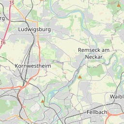
| Ludwigsburg | place:town | relation 405292 | 16 | 8 | 0 | details > |
| Landkreis Ludwigsburg | boundary:administrative | relation 62536 | 12 | 6 | 0 | details > |
| Regierungsbezirk Stuttgart | boundary:administrative | relation 22041 | 10 | 5 | 0 | details > |
| Baden-Württemberg | place:state | relation 62611 | 8 | 4 | 0 | details > |
| 71638 | place:postcode | 5 | 0 | |||
| 71638 | place:postcode | relation 1247098 | 5 | 0 | details > | |
| Deutschland | place:country | relation 51477 | 4 | 2 | ~3 m | details > |
| de | place:country_code | 4 | 0 | |||
Parent Of | ||||||
Place_of_worship | ||||||
| jesus_AG | amenity:place_of_worship | way 233295401 | 30 | ~31 m | details > | |
Building | ||||||
| No Name | building:yes | way 383451835 | 30 | ~22 m | details > | |
| No Name | building:yes | way 383451836 | 30 | ~12 m | details > | |
| No Name | building:yes | way 138406886 | 30 | ~55 m | details > | |
| No Name | building:yes | way 547223491 | 30 | ~7 m | details > | |
House | ||||||
| No Name | place:house | node 5287401909 | 30 | ~16 m | details > | |
| No Name | place:house | node 5287401908 | 30 | ~25 m | details > | |