| Name | Siggen (name)
|
| Type | place:hamlet |
| Last Updated | 2018-12-03 18:08 |
| Admin Level | 15 |
| Rank | Other: 19 |
| Importance | 0.275 (estimated) |
| Coverage | Polygon |
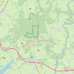
| Centre Point | 47.7123376,9.9469392 |
| OSM | way 121769224 |
| Computed Postcode | |
| Address Tags | Argenbühl,Ravensburg,Tübingen,Baden-Württemberg,Bundesrepublik Deutschland,Europe (is_in)
|
| Extra Tags | village (place)
171 (population)
|
| Local name | Type | OSM | Address rank | Admin level | Distance | |
| Siggen | place:hamlet | way 121769224 | 16 | 0 | details > | |
| Argenbühl | place:village | relation 2806737 | 16 | 8 | 0 | details > |
| Landkreis Ravensburg | place:county | relation 2808774 | 12 | 6 | 0 | details > |
| Regierungsbezirk Tübingen | boundary:administrative | relation 2811874 | 10 | 5 | 0 | details > |
| Baden-Württemberg | place:state | relation 62611 | 8 | 4 | ~1 m | details > |
| Deutschland | place:country | relation 51477 | 4 | 2 | ~4 m | details > |
| de | place:country_code | 4 | 0 | |||
Linked Places | ||||||
| Siggen | place:village | node 1856130629 | 16 | 0 | details > | |
Parent Of | ||||||
Tertiary | ||||||
| Albriser Straße | highway:tertiary | way 71144296 | 26 | ~296 m | details > | |
| Göttlishofer Straße | highway:tertiary | way 27333843 | 26 | ~89 m | details > | |
| K 8044 | highway:tertiary | way 24032102 | 26 | ~279 m | details > | |
Residential | ||||||
| Am Kirchberg | highway:residential | way 121664539 | 26 | ~174 m | details > | |
| Maria-Felder-Weg | highway:residential | way 361078549 | 26 | ~57 m | details > | |
| Rosenhalde | highway:residential | way 251244210 | 26 | ~100 m | details > | |
| Walter-Schneider-Weg | highway:residential | way 361078363 | 26 | ~10 m | details > | |
| Zum Lanzenbühl | highway:residential | way 121665121 | 26 | ~143 m | details > | |
| Zum Lanzenbühl | highway:residential | way 121664538 | 26 | ~182 m | details > | |
| No Name | highway:residential | way 24032124 | 26 | ~101 m | details > | |