| Name | Unterharmersbach (name)
|
| Type | place:village |
| Last Updated | 2018-12-03 18:16 |
| Admin Level | 15 |
| Rank | Other: 19 |
| Importance | 0.275 (estimated) |
| Coverage | Polygon |
| Centre Point | 48.35212255,8.08281028001132 |
| OSM | way 133234532 |
| Computed Postcode | 77736 |
| Address Tags | Zell am Harmersbach (is_in)
77736 (postcode)
|
| Extra Tags |
| Local name | Type | OSM | Address rank | Admin level | Distance | |
| Unterharmersbach | place:village | way 133234532 | 16 | 0 | details > | |
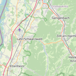
| Zell am Harmersbach | place:town | relation 453018 | 16 | 8 | 0 | details > |
| Verwaltungsgemeinschaft Zell am Harmersbach | boundary:administrative | relation 2979869 | 14 | 7 | 0 | details > |
| Ortenaukreis | place:county | relation 62624 | 12 | 6 | 0 | details > |
| Regierungsbezirk Freiburg | boundary:administrative | relation 2106112 | 10 | 5 | 0 | details > |
| Baden-Württemberg | place:state | relation 62611 | 8 | 4 | 0 | details > |
| 77736 | place:postcode | 5 | 0 | |||
| Deutschland | place:country | relation 51477 | 4 | 2 | ~4 m | details > |
| de | place:country_code | 4 | 0 | |||
Parent Of | ||||||
Park | ||||||
| Kurgarten | leisure:park | way 232966198 | 0 | ~155 m | details > | |
Residential | ||||||
| Am Rathaus | highway:residential | way 132511126 | 26 | ~67 m | details > | |
| Buchenwaldstraße | highway:residential | way 32604117 | 26 | ~303 m | details > | |
| Im Buchenfeld | highway:residential | way 128763845 | 26 | ~264 m | details > | |
| Im Buchenfeld | highway:residential | way 128763846 | 26 | ~206 m | details > | |
| Rebhalde | highway:residential | way 107281827 | 26 | ~233 m | details > | |
| Rösslematt | highway:residential | way 118030613 | 26 | ~55 m | details > | |
| Rösslematt | highway:residential | way 224545653 | 26 | ~57 m | details > | |
| Rösslematt | highway:residential | way 118030614 | 26 | ~102 m | details > | |
| Sportstättenstraße | highway:residential | way 32604122 | 26 | ~25 m | details > | |
| Steinrücken | highway:residential | way 119741230 | 26 | ~293 m | details > | |
Secondary | ||||||
| Hauptstraße | highway:secondary | way 33117855 | 26 | ~163 m | details > | |
| Hauptstraße | highway:secondary | way 33117851 | 26 | ~178 m | details > | |
| Hauptstraße | highway:secondary | way 262071675 | 26 | ~24 m | details > | |
Service | ||||||
| Feuerwehrausfahrt | highway:service | way 132511124 | 27 | ~92 m | details > | |
| Mühlweg | highway:service | way 226125806 | 27 | ~63 m | details > | |
Footway | ||||||
| Reichstalpfad | highway:footway | way 225079764 | 27 | ~145 m | details > | |
| Reichstalpfad | highway:footway | way 117617881 | 27 | ~43 m | details > | |
Path | ||||||
| Reichstalpfad | highway:path | way 578011374 | 27 | ~161 m | details > | |