| Name | E 41 (int_ref)
A 81 (ref)
|
| Type | highway:motorway |
| Last Updated | 2018-12-04 18:27 |
| Admin Level | 15 |
| Rank | Street / Major Landmark |
| Importance | 0.1 (estimated) |
| Coverage | Point |
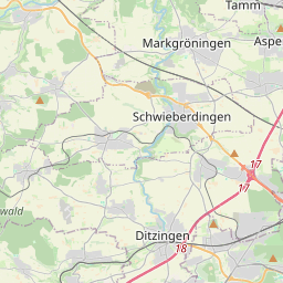
| Centre Point | 48.870517,9.1349144 |
| OSM | way 134469588 |
| Computed Postcode | 71696 |
| Address Tags | |
| Extra Tags | 3 (lanes)
signals (maxspeed)
yes (oneway)
asphalt (surface)
|
| Local name | Type | OSM | Address rank | Admin level | Distance | |
| A 81 | highway:motorway | way 134469588 | 26 | 0 | details > | |
| Müllerheim | place:suburb | node 218766156 | 20 | 0 | details > | |
| Kallenberg | place:suburb | node 4239974006 | 20 | 0 | details > | |
| Möglingen | place:village | relation 405810 | 16 | 8 | 0 | details > |
| Landkreis Ludwigsburg | boundary:administrative | relation 62536 | 12 | 6 | 0 | details > |
| Regierungsbezirk Stuttgart | boundary:administrative | relation 22041 | 10 | 5 | 0 | details > |
| Baden-Württemberg | place:state | relation 62611 | 8 | 4 | 0 | details > |
| 71696 | place:postcode | 5 | 0 | |||
| 71696 | place:postcode | relation 3377983 | 5 | 0 | details > | |
| Deutschland | place:country | relation 51477 | 4 | 2 | ~3 m | details > |
| de | place:country_code | 4 | 0 | |||
Parent Of | ||||||
Gantry | ||||||
| AQ N 7 km 570.100 | man_made:gantry | way 301005225 | 30 | ~330 m | details > | |
| No Name | man_made:gantry | way 551515211 | 30 | ~257 m | details > | |
Phone | ||||||
| No Name | emergency:phone | node 1601720857 | 30 | ~237 m | details > | |