| Name | Rathaus (name)
|
| Type | amenity:townhall |
| Last Updated | 2018-12-10 03:09 |
| Admin Level | 15 |
| Rank | Other: 30 |
| Coverage | Polygon |
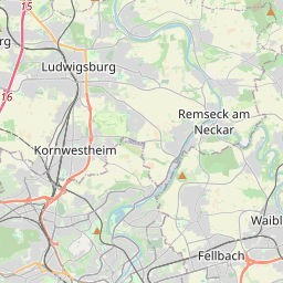
| Centre Point | 48.89594355,9.19166996151288 |
| OSM | way 137770279 |
| Computed Postcode | 71638 |
| Address Tags | Ludwigsburg (city)
DE (country)
11 (housenumber)
71638 (postcode)
Wilhelmstraße (street)
|
| Extra Tags | http://www.ludwigsburg.de/servlet/PB/menu/1235528_l1/kontakt.html (website)
yes (wheelchair)
|
| Local name | Type | OSM | Address rank | Admin level | Distance | |
| Rathaus | amenity:townhall | 29 | 0 | details > | ||
| 11 | place:house_number | 28 | 0 | details > | ||
| Wilhelmstraße | highway:tertiary | way 136899044 | 26 | 0 | details > | |
| Karlshöhe | place:neighbourhood | node 1801368070 | 22 | 0 | details > | |
| Ludwigsburg-Mitte | place:suburb | relation 6717767 | 20 | 10 | 0 | details > |
| Ludwigsburg | place:town | relation 405292 | 16 | 8 | 0 | details > |
| Landkreis Ludwigsburg | boundary:administrative | relation 62536 | 12 | 6 | 0 | details > |
| Regierungsbezirk Stuttgart | boundary:administrative | relation 22041 | 10 | 5 | 0 | details > |
| Baden-Württemberg | place:state | relation 62611 | 8 | 4 | 0 | details > |
| 71638 | place:postcode | 5 | 0 | |||
| 71638 | place:postcode | relation 1247098 | 5 | 0 | details > | |
| Deutschland | place:country | relation 51477 | 4 | 2 | ~3 m | details > |
| de | place:country_code | 4 | 0 |