| Name | Hauptstraße (name)
|
| Type | highway:tertiary |
| Last Updated | 2018-12-04 18:25 |
| Admin Level | 15 |
| Rank | Street / Major Landmark |
| Importance | 0.1 (estimated) |
| Coverage | Point |
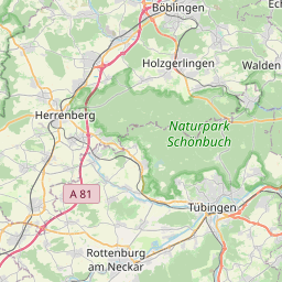
| Centre Point | 48.6413797,8.9049004 |
| OSM | way 142669141 |
| Computed Postcode | 71116 |
| Address Tags | |
| Extra Tags | 50 (maxspeed)
no (oneway)
asphalt (surface)
|
| Local name | Type | OSM | Address rank | Admin level | Distance | |
| Hauptstraße | highway:tertiary | way 142669141 | 26 | 0 | details > | |
| Lindenhof | place:isolated_dwelling | node 3465693065 | 20 | 0 | details > | |
| Steinighof | place:isolated_dwelling | node 3465735173 | 20 | 0 | details > | |
| Kirchtalhof | place:isolated_dwelling | node 3465693064 | 20 | 0 | details > | |
| Berghof | place:isolated_dwelling | node 3465693063 | 20 | 0 | details > | |
| Gärtringen | place:village | relation 557082 | 16 | 8 | 0 | details > |
| Gemeindeverwaltungsverband Gärtringen/Ehningen | boundary:administrative | relation 1609072 | 14 | 7 | 0 | details > |
| Landkreis Böblingen | boundary:administrative | relation 62721 | 12 | 6 | 0 | details > |
| Regierungsbezirk Stuttgart | boundary:administrative | relation 22041 | 10 | 5 | 0 | details > |
| Baden-Württemberg | place:state | relation 62611 | 8 | 4 | 0 | details > |
| 71116 | place:postcode | 5 | 0 | |||
| 71116 | place:postcode | relation 3376540 | 5 | 0 | details > | |
| Deutschland | place:country | relation 51477 | 4 | 2 | ~3 m | details > |
| de | place:country_code | 4 | 0 | |||
Parent Of | ||||||
Building | ||||||
| No Name | building:yes | way 60117216 | 30 | ~23 m | details > | |
| No Name | building:yes | way 60117219 | 30 | ~7 m | details > | |
| No Name | building:yes | way 177368691 | 30 | ~25 m | details > | |
| No Name | building:yes | way 60117221 | 30 | ~14 m | details > | |
| No Name | building:yes | way 266896908 | 30 | ~22 m | details > | |
Information | ||||||
| No Name | tourism:information | node 734996796 | 30 | ~55 m | details > | |