| Name | Altostraße (name)
|
| Type | highway:residential |
| Last Updated | 2018-12-04 10:43 |
| Admin Level | 15 |
| Rank | Street / Major Landmark |
| Importance | 0.1 (estimated) |
| Coverage | Point |
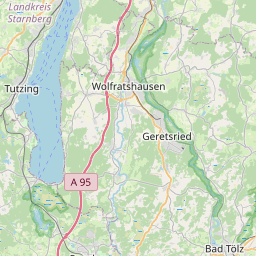
| Centre Point | 48.0297344,11.3644114 |
| OSM | way 164949860 |
| Computed Postcode | 82319 |
| Address Tags | |
| Extra Tags | 100 (maxspeed)
|
| Local name | Type | OSM | Address rank | Admin level | Distance | |
| Altostraße | highway:residential | way 164949860 | 26 | 0 | details > | |
| Starnberg | place:town | relation 932485 | 16 | 8 | 0 | details > |
| Petersbrunn | place:hamlet | node 2494863217 | 16 | 0 | details > | |
| Leutstetten | place:village | node 1700541706 | 16 | 0 | details > | |
| Mühlthal | place:hamlet | node 1700541710 | 16 | 0 | details > | |
| Einbettl | place:hamlet | node 1072619071 | 16 | 0 | details > | |
| Gut Rieden | place:hamlet | node 1700541719 | 16 | 0 | details > | |
| Landkreis Starnberg | boundary:administrative | relation 62458 | 12 | 6 | 0 | details > |
| Obb | boundary:administrative | relation 2145274 | 10 | 5 | 0 | details > |
| Bayern | place:state | relation 2145268 | 8 | 4 | 0 | details > |
| 82319 | place:postcode | 5 | 0 | |||
| 82319 | place:postcode | relation 1104735 | 5 | 0 | details > | |
| Deutschland | place:country | relation 51477 | 4 | 2 | ~3 m | details > |
| de | place:country_code | 4 | 0 | |||
Parent Of | ||||||
Viewpoint | ||||||
| No Name | tourism:viewpoint | node 1241254125 | 30 | ~270 m | details > | |
Picnic_table | ||||||
| No Name | leisure:picnic_table | node 4200119323 | 30 | ~51 m | details > | |