| Name | Ugenhofer Straße (name)
|
| Type | highway:unclassified |
| Last Updated | 2018-12-04 13:56 |
| Admin Level | 15 |
| Rank | Street / Major Landmark |
| Importance | 0.1 (estimated) |
| Coverage | Point |
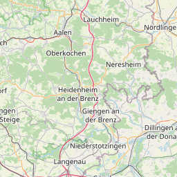
| Centre Point | 48.6352274,10.1369523 |
| OSM | way 170046671 |
| Computed Postcode | 89542 |
| Address Tags | |
| Extra Tags | paved (surface)
|
| Local name | Type | OSM | Address rank | Admin level | Distance | |
| Ugenhofer Straße | highway:unclassified | way 170046671 | 26 | 0 | details > | |
| Bolheim | boundary:administrative | relation 2873834 | 20 | 10 | 0 | details > |
| Bolheim | boundary:administrative | relation 3008677 | 18 | 9 | 0 | details > |
| Herbrechtingen | place:town | relation 2791216 | 16 | 8 | 0 | details > |
| Landkreis Heidenheim | boundary:administrative | relation 2812850 | 12 | 6 | 0 | details > |
| Regierungsbezirk Stuttgart | boundary:administrative | relation 22041 | 10 | 5 | 0 | details > |
| Baden-Württemberg | place:state | relation 62611 | 8 | 4 | ~1 m | details > |
| 89542 | place:postcode | 5 | 0 | |||
| 89542 | place:postcode | relation 1141136 | 5 | 0 | details > | |
| Deutschland | place:country | relation 51477 | 4 | 2 | ~3 m | details > |
| de | place:country_code | 4 | 0 | |||
Parent Of | ||||||
Protected_area | ||||||
| LSG Hasenloch mit Orstelhalde, Lindach, Stüzel und Heidental | boundary:protected_area | way 333925919 | 0 | ~154 m | details > | |
Cave_entrance | ||||||
| Lindachhöhle | natural:cave_entrance | node 1762549365 | 30 | ~158 m | details > | |
Archaeological_site | ||||||
| Urweltpfad - 10. Karstgeheimnisse (Fundstelle) | historic:archaeological_site | node 1342229930 | 30 | ~166 m | details > | |
Embankment | ||||||
| No Name | man_made:embankment | way 231033292 | 30 | ~141 m | details > | |