| Name | Wochenendhausgebiet Am Stangenhau (name)
|
| Type | landuse:allotments |
| Last Updated | 2018-12-03 20:21 |
| Admin Level | 15 |
| Rank | Croft / Farm / Locality / Islet |
| Importance | 0.2 (estimated) |
| Coverage | Polygon |
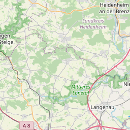
| Centre Point | 48.63979895,10.1684011804579 |
| OSM | way 198217718 |
| Computed Postcode | 89542 |
| Address Tags | |
| Extra Tags |
| Local name | Type | OSM | Address rank | Admin level | Distance | |
| Wochenendhausgebiet Am Stangenhau | landuse:allotments | way 198217718 | 22 | 0 | details > | |
| Bolheim | boundary:administrative | relation 2873834 | 20 | 10 | 0 | details > |
| Bolheim | boundary:administrative | relation 3008677 | 18 | 9 | 0 | details > |
| Herbrechtingen | place:town | relation 2791216 | 16 | 8 | 0 | details > |
| Landkreis Heidenheim | boundary:administrative | relation 2812850 | 12 | 6 | 0 | details > |
| Regierungsbezirk Stuttgart | boundary:administrative | relation 22041 | 10 | 5 | 0 | details > |
| Baden-Württemberg | place:state | relation 62611 | 8 | 4 | ~1 m | details > |
| 89542 | place:postcode | 5 | 0 | |||
| 89542 | place:postcode | relation 1141136 | 5 | 0 | details > | |
| Deutschland | place:country | relation 51477 | 4 | 2 | ~3 m | details > |
| de | place:country_code | 4 | 0 | |||
Parent Of | ||||||
Track | ||||||
| Weg 1 | highway:track | way 174342234 | 26 | ~388 m | details > | |
| Weg 2 | highway:track | way 241785276 | 26 | ~231 m | details > | |
| Weg 2 | highway:track | way 343927658 | 26 | ~233 m | details > | |
| Weg 2 | highway:track | way 510811573 | 26 | ~231 m | details > | |
| Weg 2 | highway:track | way 343092246 | 26 | ~254 m | details > | |
| Weg 3 | highway:track | way 319704624 | 26 | ~54 m | details > | |
| Weg 4 | highway:track | way 319704616 | 26 | ~128 m | details > | |
| Weg 5 | highway:track | way 174342241 | 26 | ~268 m | details > | |
| Weg 6 | highway:track | way 319704629 | 26 | ~394 m | details > | |
| Weg 7 | highway:track | way 174342231 | 26 | ~524 m | details > | |