| Name | Naturlehrpfad (name)
|
| Type | highway:path |
| Last Updated | 2018-12-05 13:18 |
| Admin Level | 15 |
| Rank | Minory Street / Path |
| Importance | 0.075 (estimated) |
| Coverage | Point |
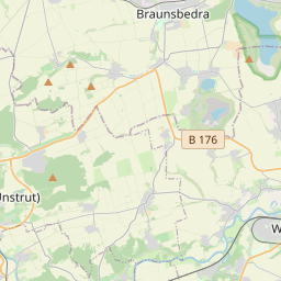
| Centre Point | 51.175195,11.8967941 |
| OSM | way 217799759 |
| Computed Postcode | 06667 |
| Address Tags | |
| Extra Tags | grade5 (tracktype)
|
| Local name | Type | OSM | Address rank | Admin level | Distance | |
| Naturlehrpfad | highway:path | way 217799759 | 27 | 0 | details > | |
| Leißling | boundary:administrative | relation 2405457 | 20 | 10 | 0 | details > |
| Weißenfels | place:town | relation 2405268 | 16 | 8 | 0 | details > |
| Plennschütz | place:village | node 1896164827 | 16 | 0 | details > | |
| Plotha | place:village | node 1896164830 | 16 | 0 | details > | |
| Pohlitz | place:village | node 472391110 | 16 | 0 | details > | |
| Leißling | place:village | node 34091005 | 16 | 0 | details > | |
| Lobitzsch | place:village | node 277290568 | 16 | 0 | details > | |
| Burgenlandkreis | place:county | relation 62639 | 12 | 6 | 0 | details > |
| Sachsen-Anhalt | place:state | relation 62607 | 8 | 4 | 0 | details > |
| 06667 | place:postcode | 5 | 0 | |||
| 06667 | place:postcode | relation 2405335 | 5 | 0 | details > | |
| Deutschland | place:country | relation 51477 | 4 | 2 | ~2 m | details > |
| de | place:country_code | 4 | 0 | |||
Parent Of | ||||||
Information | ||||||
| No Name | tourism:information | node 3338104993 | 30 | ~59 m | details > | |
Bench | ||||||
| No Name | amenity:bench | node 1879775468 | 30 | ~52 m | details > | |