| Name | Wäldle (name)
|
| Type | highway:residential |
| Last Updated | 2018-12-04 10:40 |
| Admin Level | 15 |
| Rank | Street / Major Landmark |
| Importance | 0.1 (estimated) |
| Coverage | Point |
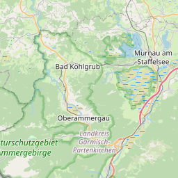
| Centre Point | 47.6737425,11.0520333 |
| OSM | way 217837055 |
| Computed Postcode | 82433 |
| Address Tags | |
| Extra Tags |
| Local name | Type | OSM | Address rank | Admin level | Distance | |
| Wäldle | highway:residential | way 217837055 | 26 | 0 | details > | |
| Schönau | place:isolated_dwelling | node 5527158483 | 20 | 0 | details > | |
| Bad Kohlgrub | place:town | relation 937894 | 16 | 8 | 0 | details > |
| Hinterkehr | place:hamlet | node 3113243455 | 16 | 0 | details > | |
| Rochusfeld | place:hamlet | node 1700556875 | 16 | 0 | details > | |
| Gagers | place:village | node 1700556857 | 16 | 0 | details > | |
| Linden | place:village | node 1724649422 | 16 | 0 | details > | |
| Wäldle | place:hamlet | node 1724649613 | 16 | 0 | details > | |
| Vorderkehr | place:hamlet | node 1724649588 | 16 | 0 | details > | |
| Landkreis Garmisch-Partenkirchen | boundary:administrative | relation 62726 | 12 | 6 | 0 | details > |
| Obb | boundary:administrative | relation 2145274 | 10 | 5 | 0 | details > |
| Bayern | place:state | relation 2145268 | 8 | 4 | ~1 m | details > |
| 82433 | place:postcode | 5 | 0 | |||
| 82433 | place:postcode | relation 1109071 | 5 | 0 | details > | |
| Deutschland | place:country | relation 51477 | 4 | 2 | ~4 m | details > |
| de | place:country_code | 4 | 0 | |||
Parent Of | ||||||
Building | ||||||
| No Name | building:yes | way 167884665 | 30 | ~63 m | details > | |
| No Name | building:yes | way 239916149 | 30 | ~16 m | details > | |
| No Name | building:yes | way 239916167 | 30 | ~8 m | details > | |
| No Name | building:yes | way 239916168 | 30 | ~29 m | details > | |