| Name | Hinter den Bühlen (name)
|
| Type | landuse:residential |
| Last Updated | 2018-12-03 20:21 |
| Admin Level | 15 |
| Rank | Croft / Farm / Locality / Islet |
| Importance | 0.2 (estimated) |
| Coverage | Polygon |
| Centre Point | 48.6373591,10.1508861942279 |
| OSM | way 224491974 |
| Computed Postcode | 89542 |
| Address Tags | |
| Extra Tags |
| Local name | Type | OSM | Address rank | Admin level | Distance | |
| Hinter den Bühlen | landuse:residential | way 224491974 | 22 | 0 | details > | |
| Bolheim | boundary:administrative | relation 2873834 | 20 | 10 | 0 | details > |
| Bolheim | boundary:administrative | relation 3008677 | 18 | 9 | 0 | details > |
| Bolheim | place:village | way 494830142 | 16 | 0 | details > | |
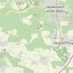
| Herbrechtingen | place:town | relation 2791216 | 16 | 8 | 0 | details > |
| Landkreis Heidenheim | boundary:administrative | relation 2812850 | 12 | 6 | 0 | details > |
| Regierungsbezirk Stuttgart | boundary:administrative | relation 22041 | 10 | 5 | 0 | details > |
| Baden-Württemberg | place:state | relation 62611 | 8 | 4 | ~1 m | details > |
| 89542 | place:postcode | 5 | 0 | |||
| 89542 | place:postcode | relation 1141136 | 5 | 0 | details > | |
| Deutschland | place:country | relation 51477 | 4 | 2 | ~3 m | details > |
| de | place:country_code | 4 | 0 | |||
Parent Of | ||||||
Residential | ||||||
| Ahornweg | highway:residential | way 224492226 | 26 | ~14 m | details > | |
| Bergstraße | highway:residential | way 224491469 | 26 | ~271 m | details > | |
| Bergstraße | highway:residential | way 28268581 | 26 | ~271 m | details > | |
| Bergstraße | highway:residential | way 224491472 | 26 | ~209 m | details > | |
| Bergstraße | highway:residential | way 163716664 | 26 | ~250 m | details > | |
| Bergstraße | highway:residential | way 224492227 | 26 | ~60 m | details > | |
| Bühlstraße | highway:residential | way 173530455 | 26 | ~93 m | details > | |
| Eichenweg | highway:residential | way 173498603 | 26 | ~89 m | details > | |
| Fichtenweg | highway:residential | way 173530457 | 26 | ~60 m | details > | |
| Heckenstraße | highway:residential | way 25806762 | 26 | ~45 m | details > | |
| Heckenstraße | highway:residential | way 224492140 | 26 | ~45 m | details > | |
| Sonnenrain | highway:residential | way 173498606 | 26 | ~140 m | details > | |
| Tannenweg | highway:residential | way 173345262 | 26 | ~47 m | details > | |
| Wachholderweg | highway:residential | way 266560560 | 26 | ~129 m | details > | |
| Waldstraße | highway:residential | way 224516764 | 26 | ~140 m | details > | |
| Waldstraße | highway:residential | way 25806760 | 26 | ~128 m | details > | |
| Waldstraße | highway:residential | way 221662553 | 26 | ~171 m | details > | |
| Waldstraße | highway:residential | way 220882177 | 26 | ~208 m | details > | |
Living_street | ||||||
| Storkenreuteweg | highway:living_street | way 221662552 | 26 | ~212 m | details > | |
Service | ||||||
| Bergstraße | highway:service | way 224497905 | 27 | ~263 m | details > | |
Path | ||||||
| Sonnenrain | highway:path | way 220880947 | 27 | ~266 m | details > | |