| Name | Am Emanuelsberg (name)
Am Emanuelsberg (name:de)
Kratzberg (old_name)
|
| Type | highway:residential |
| Last Updated | 2018-12-04 12:57 |
| Admin Level | 15 |
| Rank | Street / Major Landmark |
| Importance | 0.1 (estimated) |
| Coverage | Point |
| Centre Point | 50.9961075,9.7169384 |
| OSM | way 225001517 |
| Computed Postcode | 36199 |
| Address Tags | |
| Extra Tags | paved (surface)
grade1 (tracktype)
agricultural (vehicle)
|
| Local name | Type | OSM | Address rank | Admin level | Distance | |
| Am Emanuelsberg | highway:residential | way 225001517 | 26 | 0 | details > | |
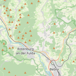
| Rotenburg a.d. Fulda | place:town | relation 238957 | 16 | 8 | 0 | details > |
| Landkreis Hersfeld-Rotenburg | place:county | relation 62637 | 12 | 6 | 0 | details > |
| Regierungsbezirk Kassel | boundary:administrative | relation 286675 | 10 | 5 | 0 | details > |
| Hessen | place:state | relation 62650 | 8 | 4 | 0 | details > |
| 36199 | place:postcode | 5 | 0 | |||
| 36199 | place:postcode | relation 3356261 | 5 | 0 | details > | |
| Deutschland | place:country | relation 51477 | 4 | 2 | 0 | details > |
| de | place:country_code | 4 | 0 | |||
| Europe | place:continent | node 25871341 | 2 | 0 | details > | |
Parent Of | ||||||
Parking | ||||||
| Landkreis Hersfeld-Rotenburg | amenity:parking | way 338168757 | 30 | ~314 m | details > | |
Hostel | ||||||
| der Jugendhof Landkreis Hersfeld-Rotenburg | tourism:hostel | way 338168758 | 30 | ~233 m | details > | |
| der jugendhof Landkreis Hersfeld-Rotenburg | tourism:hostel | way 338168759 | 30 | ~352 m | details > | |
House | ||||||
| No Name | place:house | node 3364245306 | 30 | ~231 m | details > | |
Pitch | ||||||
| No Name | leisure:pitch | way 338168761 | 30 | ~133 m | details > | |
Playground | ||||||
| No Name | leisure:playground | way 338168760 | 30 | ~338 m | details > | |