| Name | Vollmarshäuser Straße (name)
Vollmarshäuser Straße (name:de)
L 3203 (ref)
|
| Type | highway:secondary |
| Last Updated | 2018-12-04 12:57 |
| Admin Level | 15 |
| Rank | Street / Major Landmark |
| Importance | 0.1 (estimated) |
| Coverage | Point |
| Centre Point | 51.2628144,9.5607518 |
| OSM | way 225133430 |
| Computed Postcode | 34253 |
| Address Tags | |
| Extra Tags | 50 (maxspeed)
|
| Local name | Type | OSM | Address rank | Admin level | Distance | |
| Vollmarshäuser Straße | highway:secondary | way 225133430 | 26 | 0 | details > | |
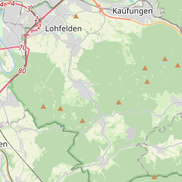
| Lohfelden | place:town | relation 1115032 | 16 | 8 | 0 | details > |
| Vollmarshausen | place:village | node 423768357 | 16 | 0 | details > | |
| Landkreis Kassel | place:county | relation 62401 | 12 | 6 | 0 | details > |
| Regierungsbezirk Kassel | boundary:administrative | relation 286675 | 10 | 5 | 0 | details > |
| Hessen | place:state | relation 62650 | 8 | 4 | 0 | details > |
| 34253 | place:postcode | 5 | 0 | |||
| 34253 | place:postcode | relation 3356553 | 5 | 0 | details > | |
| Deutschland | place:country | relation 51477 | 4 | 2 | 0 | details > |
| de | place:country_code | 4 | 0 | |||
| Europe | place:continent | node 25871341 | 2 | 0 | details > | |
Parent Of | ||||||
Bus_stop | ||||||
| Friedhof | highway:bus_stop | node 305430432 | 30 | ~55 m | details > | |
| Friedhof | highway:bus_stop | node 305430434 | 30 | ~64 m | details > | |
Waste_basket | ||||||
| No Name | amenity:waste_basket | node 3202091953 | 30 | ~55 m | details > | |
| No Name | amenity:waste_basket | node 3202091952 | 30 | ~65 m | details > | |
Bench | ||||||
| No Name | amenity:bench | node 3202091954 | 30 | ~57 m | details > | |
Street_lamp | ||||||
| No Name | highway:street_lamp | node 3202126642 | 30 | ~80 m | details > | |
| No Name | highway:street_lamp | node 3202126641 | 30 | ~44 m | details > | |
| No Name | highway:street_lamp | node 3202126640 | 30 | ~7 m | details > | |