| Name | Fehmarnsund (name)
|
| Type | place:village |
| Last Updated | 2018-12-03 17:59 |
| Admin Level | 15 |
| Rank | Other: 19 |
| Importance | 0.275 (estimated) |
| Coverage | Polygon |
| Centre Point | 54.4045479,11.1216692 |
| OSM | way 226398173 |
| Computed Postcode | |
| Address Tags | |
| Extra Tags | village (place)
|
| Local name | Type | OSM | Address rank | Admin level | Distance | |
| Fehmarnsund | place:village | way 226398173 | 16 | 0 | details > | |
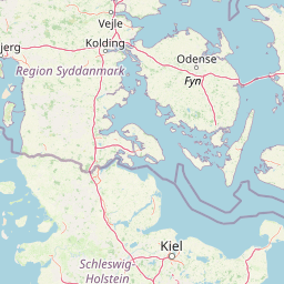
| Fehmarn | boundary:administrative | relation 382448 | 16 | 8 | 0 | details > |
| Ostholstein | place:county | relation 27025 | 12 | 6 | 0 | details > |
| Schleswig-Holstein | place:state | relation 51529 | 8 | 4 | ~2 m | details > |
| Deutschland | place:country | relation 51477 | 4 | 2 | ~3 m | details > |
| de | place:country_code | 4 | 0 | |||
Linked Places | ||||||
| Fehmarnsund | place:village | node 2352329925 | 16 | 0 | details > | |
Parent Of | ||||||
Unclassified | ||||||
| No Name | highway:unclassified | way 30683601 | 26 | ~75 m | details > | |
| No Name | highway:unclassified | way 24254691 | 26 | ~43 m | details > | |
Residential | ||||||
| No Name | highway:residential | way 311875102 | 26 | ~25 m | details > | |
| No Name | highway:residential | way 52107179 | 26 | ~75 m | details > | |
Path | ||||||
| Fehmarnsund | highway:path | way 39309123 | 27 | ~75 m | details > | |
Apartment | ||||||
| FeWo Minni | tourism:apartment | node 2424134835 | 30 | ~617 m | details > | |
| FeWo Romeo | tourism:apartment | node 2424133534 | 30 | ~603 m | details > | |
Chalet | ||||||
| Ferienhaus Fehmarnsund 30 | tourism:chalet | way 163548322 | 30 | ~527 m | details > | |
Building | ||||||
| Haus Vogelflug | building:yes | way 571078288 | 30 | ~657 m | details > | |
| Haus Vogelflug | building:yes | way 33815796 | 30 | ~642 m | details > | |
House | ||||||
| No Name | place:house | node 2487204368 | 30 | ~130 m | details > | |
| No Name | place:house | node 2487204370 | 30 | ~84 m | details > | |