| Name | Steinköhlerspfad (name)
|
| Type | highway:track |
| Last Updated | 2018-12-04 12:56 |
| Admin Level | 15 |
| Rank | Street / Major Landmark |
| Importance | 0.1 (estimated) |
| Coverage | Point |
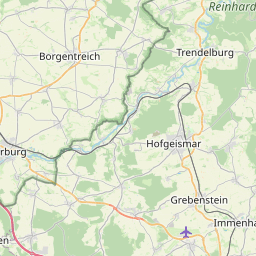
| Centre Point | 51.4306685,9.5650658 |
| OSM | way 234468180 |
| Computed Postcode | 34369 |
| Address Tags | |
| Extra Tags | gravel (surface)
grade2 (tracktype)
|
| Local name | Type | OSM | Address rank | Admin level | Distance | |
| Steinköhlerspfad | highway:track | way 234468180 | 26 | 0 | details > | |
| Gutsbezirk Reinhardswald | boundary:administrative | relation 1112224 | 16 | 8 | 0 | details > |
| Wilhelmshausen | place:village | node 67213588 | 16 | 0 | details > | |
| Holzhausen | place:village | node 65032535 | 16 | 0 | details > | |
| Knickhagen | place:village | node 67216306 | 16 | 0 | details > | |
| Landkreis Kassel | place:county | relation 62401 | 12 | 6 | 0 | details > |
| Regierungsbezirk Kassel | boundary:administrative | relation 286675 | 10 | 5 | 0 | details > |
| Hessen | place:state | relation 62650 | 8 | 4 | 0 | details > |
| 34369 | place:postcode | 5 | 0 | |||
| 34369 | place:postcode | relation 1189901 | 5 | 0 | details > | |
| Deutschland | place:country | relation 51477 | 4 | 2 | 0 | details > |
| de | place:country_code | 4 | 0 | |||
| Europe | place:continent | node 25871341 | 2 | 0 | details > | |
Parent Of | ||||||
Water | ||||||
| Alaunteich | natural:water | way 126050923 | 30 | ~779 m | details > | |
Information | ||||||
| Wegweiser>> | tourism:information | node 1586565779 | 30 | ~783 m | details > | |
| No Name | tourism:information | node 3338643549 | 30 | ~828 m | details > | |
Hunting_stand | ||||||
| No Name | amenity:hunting_stand | node 1465195890 | 30 | ~461 m | details > | |
| No Name | amenity:hunting_stand | node 1516367705 | 30 | ~644 m | details > | |
| No Name | amenity:hunting_stand | node 1516375538 | 30 | ~1.1 km | details > | |
| No Name | amenity:hunting_stand | node 1516357512 | 30 | ~749 m | details > | |
| No Name | amenity:hunting_stand | node 1516362510 | 30 | ~412 m | details > | |
| No Name | amenity:hunting_stand | node 1516365759 | 30 | ~672 m | details > | |
| No Name | amenity:hunting_stand | node 1516371582 | 30 | ~915 m | details > | |
| No Name | amenity:hunting_stand | node 1516362520 | 30 | ~487 m | details > | |
| No Name | amenity:hunting_stand | node 1585747712 | 30 | ~839 m | details > | |
| No Name | amenity:hunting_stand | node 1585748087 | 30 | ~936 m | details > | |
| No Name | amenity:hunting_stand | node 1585748366 | 30 | ~605 m | details > | |
| No Name | amenity:hunting_stand | node 1585840409 | 30 | ~437 m | details > | |
| No Name | amenity:hunting_stand | node 1586565084 | 30 | ~608 m | details > | |
| No Name | amenity:hunting_stand | node 1586572913 | 30 | ~859 m | details > | |
| No Name | amenity:hunting_stand | node 1516369930 | 30 | ~930 m | details > | |
| No Name | amenity:hunting_stand | node 1465194654 | 30 | ~558 m | details > | |
Shelter | ||||||
| No Name | amenity:shelter | node 1422759414 | 30 | ~1 km | details > | |
Bench | ||||||
| No Name | amenity:bench | node 3338649754 | 30 | ~791 m | details > | |