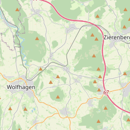
| Name | K 24 (ref)
|
| Type | highway:tertiary |
| Last Updated | 2018-12-04 16:33 |
| Admin Level | 15 |
| Rank | Street / Major Landmark |
| Importance | 0.1 (estimated) |
| Coverage | Point |
| Centre Point | 51.2933297,9.2989442 |
| OSM | way 262387916 |
| Computed Postcode | 34270 |
| Address Tags | |
| Extra Tags | 100 (maxspeed)
|
| Local name | Type | OSM | Address rank | Admin level | Distance | |
| K 24 | highway:tertiary | way 262387916 | 26 | 0 | details > | |
| Schauenburg | place:village | relation 533415 | 16 | 8 | 0 | details > |
| Martinhagen | place:village | node 246491213 | 16 | 0 | details > | |
| Landkreis Kassel | place:county | relation 62401 | 12 | 6 | 0 | details > |
| Regierungsbezirk Kassel | boundary:administrative | relation 286675 | 10 | 5 | 0 | details > |
| Hessen | place:state | relation 62650 | 8 | 4 | 0 | details > |
| 34270 | place:postcode | 5 | 0 | |||
| 34270 | place:postcode | relation 3356213 | 5 | 0 | details > | |
| Deutschland | place:country | relation 51477 | 4 | 2 | ~1 m | details > |
| de | place:country_code | 4 | 0 | |||
| Europe | place:continent | node 25871341 | 2 | 0 | details > | |
Parent Of | ||||||
Building | ||||||
| Wasserwerk | building:yes | way 255869954 | 30 | ~223 m | details > | |
Water_works | ||||||
| No Name | man_made:water_works | node 1195351199 | 30 | ~226 m | details > | |
Hunting_stand | ||||||
| No Name | amenity:hunting_stand | node 2477823427 | 30 | ~862 m | details > | |
| No Name | amenity:hunting_stand | node 2477823425 | 30 | ~733 m | details > | |
Give_way | ||||||
| No Name | highway:give_way | node 4046081323 | 30 | ~608 m | details > | |
Bench | ||||||
| No Name | amenity:bench | node 5230804386 | 30 | ~851 m | details > | |