| Name | EI 1 (ref)
|
| Type | highway:tertiary |
| Last Updated | 2018-12-04 10:06 |
| Admin Level | 15 |
| Rank | Street / Major Landmark |
| Importance | 0.1 (estimated) |
| Coverage | Point |
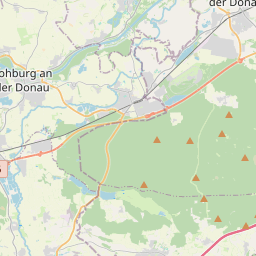
| Centre Point | 48.7822403,11.2406775 |
| OSM | way 265481291 |
| Computed Postcode | 85116 |
| Address Tags | |
| Extra Tags | 100 (maxspeed)
|
| Local name | Type | OSM | Address rank | Admin level | Distance | |
| EI 1 | highway:tertiary | way 265481291 | 26 | 0 | details > | |
| Aumühle | place:isolated_dwelling | node 3250166475 | 20 | 0 | details > | |
| Egweil | place:village | relation 943550 | 16 | 8 | 0 | details > |
| Hennenweidach | place:hamlet | node 2711373219 | 16 | 0 | details > | |
| Nassenfels (VGem) | boundary:administrative | relation 2971580 | 14 | 7 | 0 | details > |
| Landkreis Eichstätt | boundary:administrative | relation 62684 | 12 | 6 | 0 | details > |
| Obb | boundary:administrative | relation 2145274 | 10 | 5 | 0 | details > |
| Bayern | place:state | relation 2145268 | 8 | 4 | 0 | details > |
| 85116 | place:postcode | 5 | 0 | |||
| 85116 | place:postcode | relation 1100018 | 5 | 0 | details > | |
| Deutschland | place:country | relation 51477 | 4 | 2 | ~3 m | details > |
| de | place:country_code | 4 | 0 | |||
Parent Of | ||||||
Wayside_shrine | ||||||
| No Name | historic:wayside_shrine | node 3428608310 | 30 | ~262 m | details > | |