| Name | Am Schmidinger Weiher (name)
|
| Type | highway:residential |
| Last Updated | 2018-12-04 02:42 |
| Admin Level | 15 |
| Rank | Street / Major Landmark |
| Importance | 0.1 (estimated) |
| Coverage | Point |
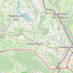
| Centre Point | 47.8212034,12.9546852 |
| OSM | way 269070530 |
| Computed Postcode | 83404 |
| Address Tags | |
| Extra Tags | no (oneway)
asphalt (surface)
|
| Local name | Type | OSM | Address rank | Admin level | Distance | |
| Am Schmidinger Weiher | highway:residential | way 269070530 | 26 | 0 | details > | |
| Gschwendt | place:isolated_dwelling | node 3635425897 | 20 | 0 | details > | |
| Ainring | place:village | relation 941761 | 16 | 8 | 0 | details > |
| Schiffmoning | place:hamlet | node 307815714 | 16 | 0 | details > | |
| Eschlberg | place:hamlet | node 279811108 | 16 | 0 | details > | |
| Heidenpoint | place:village | node 306703019 | 16 | 0 | details > | |
| Schmiding | place:hamlet | node 1704161689 | 16 | 0 | details > | |
| Mitterfelden | place:village | node 278958929 | 16 | 0 | details > | |
| Landkreis Berchtesgadener Land | boundary:administrative | relation 62712 | 12 | 6 | 0 | details > |
| Obb | boundary:administrative | relation 2145274 | 10 | 5 | ~1 m | details > |
| Bayern | place:state | relation 2145268 | 8 | 4 | ~2 m | details > |
| 83404 | place:postcode | 5 | 0 | |||
| 83404 | place:postcode | relation 1114642 | 5 | 0 | details > | |
| Deutschland | place:country | relation 51477 | 4 | 2 | ~4 m | details > |
| de | place:country_code | 4 | 0 | |||
Parent Of | ||||||
Alcohol | ||||||
| Fristo-Getränkemarkt | shop:alcohol | node 583378817 | 30 | ~23 m | details > | |
Supermarket | ||||||
| Penny | shop:supermarket | way 132668998 | 30 | ~5 m | details > | |
Parking | ||||||
| No Name | amenity:parking | way 269070537 | 30 | ~29 m | details > | |