| Name | Bietigheimer Straße (name)
Bietigheimer Straße (name:de)
K 1635 (ref)
|
| Type | highway:secondary |
| Last Updated | 2018-12-04 18:12 |
| Admin Level | 15 |
| Rank | Street / Major Landmark |
| Importance | 0.1 (estimated) |
| Coverage | Point |
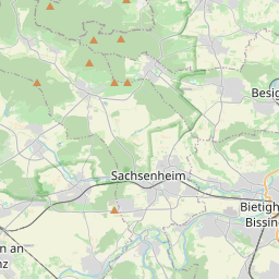
| Centre Point | 48.9681383,9.076731 |
| OSM | way 285099126 |
| Computed Postcode | 74343 |
| Address Tags | |
| Extra Tags | 2 (lanes)
50 (maxspeed)
asphalt (surface)
|
| Local name | Type | OSM | Address rank | Admin level | Distance | |
| Bietigheimer Straße | highway:secondary | way 285099126 | 26 | 0 | details > | |
| Sport- und Schulzentrum | place:neighbourhood | node 517985000 | 22 | 0 | details > | |
| Kleinsachsenheim | place:suburb | node 1651771416 | 20 | 0 | details > | |
| Sachsenheim | place:town | relation 405823 | 16 | 8 | 0 | details > |
| Untermberg | place:village | node 1457699328 | 16 | 0 | details > | |
| Waldhof | place:hamlet | node 5528598474 | 16 | 0 | details > | |
| Unterriexingen | place:village | node 278321966 | 16 | 0 | details > | |
| Petershöfe | place:hamlet | node 1805940486 | 16 | 0 | details > | |
| Leonhardshof | place:hamlet | node 5002138585 | 16 | 0 | details > | |
| Egartenhof | place:hamlet | node 1457699329 | 16 | 0 | details > | |
| Weißenhof | place:hamlet | node 1805940830 | 16 | 0 | details > | |
| Landkreis Ludwigsburg | boundary:administrative | relation 62536 | 12 | 6 | 0 | details > |
| Regierungsbezirk Stuttgart | boundary:administrative | relation 22041 | 10 | 5 | 0 | details > |
| Baden-Württemberg | place:state | relation 62611 | 8 | 4 | 0 | details > |
| 74343 | place:postcode | 5 | 0 | |||
| 74343 | place:postcode | relation 1227771 | 5 | 0 | details > | |
| Deutschland | place:country | relation 51477 | 4 | 2 | ~3 m | details > |
| de | place:country_code | 4 | 0 | |||
Parent Of | ||||||
Bench | ||||||
| No Name | amenity:bench | node 330533630 | 30 | ~11 m | details > | |
| No Name | amenity:bench | node 330533629 | 30 | ~13 m | details > | |