| Name | Isener Straße (name)
Isener Straße (name:de)
ED 18 (ref)
|
| Type | highway:tertiary |
| Last Updated | 2018-12-04 07:35 |
| Admin Level | 15 |
| Rank | Street / Major Landmark |
| Importance | 0.1 (estimated) |
| Coverage | Point |
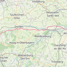
| Centre Point | 48.2190217,12.1126695 |
| OSM | way 295691524 |
| Computed Postcode | 84427 |
| Address Tags | |
| Extra Tags | 50 (maxspeed)
no (oneway)
|
| Local name | Type | OSM | Address rank | Admin level | Distance | |
| Isener Straße | highway:tertiary | way 295691524 | 26 | 0 | details > | |
| Haberstätt | place:isolated_dwelling | node 1686098880 | 20 | 0 | details > | |
| Weinthal | place:isolated_dwelling | node 1686099031 | 20 | 0 | details > | |
| Sankt Wolfgang | place:village | relation 934757 | 16 | 8 | 0 | details > |
| Erlach | place:hamlet | node 1686098998 | 16 | 0 | details > | |
| Pumpernudel | place:hamlet | node 2083303515 | 16 | 0 | details > | |
| Stangl | place:hamlet | node 1686098856 | 16 | 0 | details > | |
| Weinhub | place:hamlet | node 1086894209 | 16 | 0 | details > | |
| Feldhuber | place:hamlet | node 1686098231 | 16 | 0 | details > | |
| Hackl | place:hamlet | node 126397950 | 16 | 0 | details > | |
| Seebäck | place:hamlet | node 1686098945 | 16 | 0 | details > | |
| Erlbach | place:hamlet | node 115793211 | 16 | 0 | details > | |
| Strell | place:hamlet | node 1686098927 | 16 | 0 | details > | |
| Giglberg | place:hamlet | node 1686098207 | 16 | 0 | details > | |
| Braun | place:hamlet | node 1686098805 | 16 | 0 | details > | |
| Schindelholz | place:hamlet | node 1735718615 | 16 | 0 | details > | |
| Schönfleck | place:hamlet | node 1686098163 | 16 | 0 | details > | |
| Reisern | place:hamlet | node 1686098185 | 16 | 0 | details > | |
| Bramer | place:hamlet | node 1686098806 | 16 | 0 | details > | |
| Kaltenbrunn | place:hamlet | node 1684821890 | 16 | 0 | details > | |
| Hochreit | place:hamlet | node 459154454 | 16 | 0 | details > | |
| Hungersberg | place:hamlet | node 1686098166 | 16 | 0 | details > | |
| Holz am Berg | place:hamlet | node 1686098533 | 16 | 0 | details > | |
| Lappach | place:village | node 1799182050 | 16 | 0 | details > | |
| Lehen | place:hamlet | node 1686098292 | 16 | 0 | details > | |
| Holzen | place:hamlet | node 1686098289 | 16 | 0 | details > | |
| Landkreis Erding | boundary:administrative | relation 62356 | 12 | 6 | 0 | details > |
| Obb | boundary:administrative | relation 2145274 | 10 | 5 | 0 | details > |
| Bayern | place:state | relation 2145268 | 8 | 4 | ~1 m | details > |
| 84427 | place:postcode | 5 | 0 | |||
| 84427 | place:postcode | relation 1114041 | 5 | 0 | details > | |
| Deutschland | place:country | relation 51477 | 4 | 2 | ~4 m | details > |
| de | place:country_code | 4 | 0 | |||
Parent Of | ||||||
Bus_stop | ||||||
| Lappach (b.St.Wolfgang) | highway:bus_stop | node 622290237 | 30 | ~22 m | details > | |
| Lappach (b.St.Wolfgang) | highway:bus_stop | node 523042013 | 30 | ~84 m | details > | |
Restaurant | ||||||
| Obermaier | amenity:restaurant | node 550108971 | 30 | ~72 m | details > | |
Building | ||||||
| No Name | building:yes | way 168342275 | 30 | ~53 m | details > | |
| No Name | building:yes | way 168342272 | 30 | ~36 m | details > | |
| No Name | building:yes | way 168342270 | 30 | ~71 m | details > | |
| No Name | building:yes | way 168342280 | 30 | ~42 m | details > | |
| No Name | building:yes | way 168342269 | 30 | ~97 m | details > | |
| No Name | building:yes | way 605325397 | 30 | ~123 m | details > | |
| No Name | building:yes | way 168342268 | 30 | ~125 m | details > | |
| No Name | building:yes | way 605325398 | 30 | ~156 m | details > | |
| No Name | building:yes | way 168342267 | 30 | ~148 m | details > | |
| No Name | building:yes | way 168342266 | 30 | ~179 m | details > | |
| No Name | building:yes | way 168342264 | 30 | ~188 m | details > | |
| No Name | building:yes | way 168342276 | 30 | ~66 m | details > | |
| No Name | building:yes | way 373846532 | 30 | ~46 m | details > | |
| No Name | building:yes | way 168342274 | 30 | ~16 m | details > | |
| No Name | building:yes | way 168342273 | 30 | ~29 m | details > | |
Post_box | ||||||
| No Name | amenity:post_box | node 5548620965 | 30 | ~82 m | details > | |