| Name | Rotheben (name)
|
| Type | highway:service |
| Last Updated | 2018-12-05 13:04 |
| Admin Level | 15 |
| Rank | Minory Street / Path |
| Importance | 0.075 (estimated) |
| Coverage | Point |
| Centre Point | 47.6027517,12.9233681 |
| OSM | way 297849546 |
| Computed Postcode | 83486 |
| Address Tags | |
| Extra Tags | parking_aisle (service)
|
| Local name | Type | OSM | Address rank | Admin level | Distance | |
| Rotheben | highway:service | way 297849546 | 27 | 0 | details > | |
| Kühroint | place:isolated_dwelling | node 477293067 | 20 | 0 | details > | |
| Ramsau | place:village | relation 941797 | 16 | 8 | 0 | details > |
| Frechen | place:hamlet | node 3749517817 | 16 | 0 | details > | |
| Schapbach | place:hamlet | node 3749517816 | 16 | 0 | details > | |
| Berghof | place:hamlet | node 3749517818 | 16 | 0 | details > | |
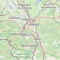
| Landkreis Berchtesgadener Land | boundary:administrative | relation 62712 | 12 | 6 | 0 | details > |
| Obb | boundary:administrative | relation 2145274 | 10 | 5 | ~1 m | details > |
| Bayern | place:state | relation 2145268 | 8 | 4 | ~2 m | details > |
| 83486 | place:postcode | 5 | 0 | |||
| 83486 | place:postcode | relation 1114656 | 5 | 0 | details > | |
| Deutschland | place:country | relation 51477 | 4 | 2 | ~5 m | details > |
| de | place:country_code | 4 | 0 | |||
Parent Of | ||||||
Parking | ||||||
| Wimbachbrücke | amenity:parking | way 180175387 | 30 | ~4 m | details > | |
Building | ||||||
| No Name | building:yes | way 293940556 | 30 | ~59 m | details > | |
| No Name | building:yes | way 293940559 | 30 | ~114 m | details > | |
| No Name | building:yes | way 293940550 | 30 | ~131 m | details > | |
| No Name | building:yes | way 293940553 | 30 | ~161 m | details > | |
| No Name | building:yes | way 293940558 | 30 | ~28 m | details > | |
| No Name | building:yes | way 226100015 | 30 | ~11 m | details > | |