| Name | Im Kugelhof (name)
|
| Type | highway:service |
| Last Updated | 2018-12-05 14:49 |
| Admin Level | 15 |
| Rank | Minory Street / Path |
| Importance | 0.075 (estimated) |
| Coverage | Point |
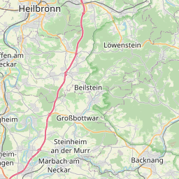
| Centre Point | 48.92106,9.5782815 |
| OSM | way 302347465 |
| Computed Postcode | 71566 |
| Address Tags | |
| Extra Tags | 30 (maxspeed)
asphalt (surface)
|
| Local name | Type | OSM | Address rank | Admin level | Distance | |
| Im Kugelhof | highway:service | way 302347465 | 27 | 0 | details > | |
| Fratzenwiesenhof | place:isolated_dwelling | node 2027799990 | 20 | 0 | details > | |
| Grasgehren | place:isolated_dwelling | node 2027808468 | 20 | 0 | details > | |
| Kaltenbronnhof | place:isolated_dwelling | node 364838255 | 20 | 0 | details > | |
| Althütte | place:village | relation 400938 | 16 | 8 | 0 | details > |
| Schlichenhöfle | place:hamlet | node 293349372 | 16 | 0 | details > | |
| Vereinbarte Verwaltungsgemeinschaft der Stadt Backnang | boundary:administrative | relation 1613874 | 14 | 7 | 0 | details > |
| Rems-Murr-Kreis | place:county | relation 62412 | 12 | 6 | 0 | details > |
| Regierungsbezirk Stuttgart | boundary:administrative | relation 22041 | 10 | 5 | 0 | details > |
| Baden-Württemberg | place:state | relation 62611 | 8 | 4 | 0 | details > |
| 71566 | place:postcode | 5 | 0 | |||
| 71566 | place:postcode | relation 3377943 | 5 | 0 | details > | |
| Deutschland | place:country | relation 51477 | 4 | 2 | ~3 m | details > |
| de | place:country_code | 4 | 0 | |||
Parent Of | ||||||
House | ||||||
| No Name | place:house | node 5417229554 | 30 | ~16 m | details > | |