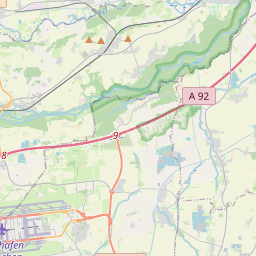
| Name | B 388 (ref)
|
| Type | highway:primary |
| Last Updated | 2018-12-04 07:34 |
| Admin Level | 15 |
| Rank | Street / Major Landmark |
| Importance | 0.1 (estimated) |
| Coverage | Point |
| Centre Point | 48.3208073,11.9650784 |
| OSM | way 306474583 |
| Computed Postcode | 85461 |
| Address Tags | |
| Extra Tags |
| Local name | Type | OSM | Address rank | Admin level | Distance | |
| B 388 | highway:primary | way 306474583 | 26 | 0 | details > | |
| Straßmeier | place:isolated_dwelling | node 2211564185 | 20 | 0 | details > | |
| Bockhorn | place:village | relation 934762 | 16 | 8 | 0 | details > |
| Unterstrogn | place:village | node 248073699 | 16 | 0 | details > | |
| Thal | place:hamlet | node 1854470262 | 16 | 0 | details > | |
| Heiderl | place:hamlet | node 1215762708 | 16 | 0 | details > | |
| Emling | place:village | node 1854470175 | 16 | 0 | details > | |
| Oberstrogn | place:hamlet | node 279300667 | 16 | 0 | details > | |
| Landkreis Erding | boundary:administrative | relation 62356 | 12 | 6 | 0 | details > |
| Obb | boundary:administrative | relation 2145274 | 10 | 5 | 0 | details > |
| Bayern | place:state | relation 2145268 | 8 | 4 | 0 | details > |
| 85461 | place:postcode | 5 | 0 | |||
| 85461 | place:postcode | relation 1100185 | 5 | 0 | details > | |
| Deutschland | place:country | relation 51477 | 4 | 2 | ~3 m | details > |
| de | place:country_code | 4 | 0 | |||
Parent Of | ||||||
Bus_stop | ||||||
| Emling | highway:bus_stop | node 1801075178 | 30 | ~18 m | details > | |
| Emling | highway:bus_stop | node 1801075177 | 30 | ~9 m | details > | |
Building | ||||||
| Hofkapelle | building:yes | way 374476130 | 30 | ~238 m | details > | |
Bunker_silo | ||||||
| No Name | man_made:bunker_silo | way 374611329 | 30 | ~170 m | details > | |
| No Name | man_made:bunker_silo | way 374611330 | 30 | ~77 m | details > | |
Taxiway | ||||||
| No Name | aeroway:taxiway | way 23072603 | 30 | ~196 m | details > | |
| No Name | aeroway:taxiway | way 30277371 | 30 | ~266 m | details > | |