| Name | Grubmühlerfeldstraße (name)
|
| Type | highway:residential |
| Last Updated | 2018-12-04 10:36 |
| Admin Level | 15 |
| Rank | Street / Major Landmark |
| Importance | 0.1 (estimated) |
| Coverage | Point |
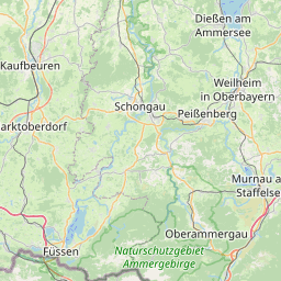
| Centre Point | 48.0690895,11.3824566 |
| OSM | way 377706968 |
| Computed Postcode | 82131 |
| Address Tags | |
| Extra Tags | 40 (maxspeed)
6 (width)
|
| Local name | Type | OSM | Address rank | Admin level | Distance | |
| Grubmühlerfeldstraße | highway:residential | way 377706968 | 26 | 0 | details > | |
| Gauting | place:town | relation 932494 | 16 | 8 | 0 | details > |
| Landkreis Starnberg | boundary:administrative | relation 62458 | 12 | 6 | 0 | details > |
| Obb | boundary:administrative | relation 2145274 | 10 | 5 | 0 | details > |
| Bayern | place:state | relation 2145268 | 8 | 4 | 0 | details > |
| 82131 | place:postcode | 5 | 0 | |||
| 82131 | place:postcode | relation 1104731 | 5 | 0 | details > | |
| Deutschland | place:country | relation 51477 | 4 | 2 | ~3 m | details > |
| de | place:country_code | 4 | 0 | |||
Parent Of | ||||||
Building | ||||||
| No Name | building:yes | way 137294057 | 30 | ~14 m | details > | |
| No Name | building:yes | way 137294046 | 30 | ~48 m | details > | |
| No Name | building:yes | way 137294050 | 30 | ~26 m | details > | |
| No Name | building:yes | way 137294059 | 30 | ~34 m | details > | |
| No Name | building:yes | way 137294060 | 30 | ~41 m | details > | |
| No Name | building:yes | way 137294047 | 30 | ~10 m | details > | |