| Name | Bahndammweg (name)
|
| Type | highway:path |
| Last Updated | 2018-12-05 14:09 |
| Admin Level | 15 |
| Rank | Minory Street / Path |
| Importance | 0.075 (estimated) |
| Coverage | Point |
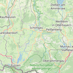
| Centre Point | 47.6683776,11.0531775 |
| OSM | way 377843459 |
| Computed Postcode | 82433 |
| Address Tags | |
| Extra Tags | paved (surface)
1 m (width)
|
| Local name | Type | OSM | Address rank | Admin level | Distance | |
| Bahndammweg | highway:path | way 377843459 | 27 | 0 | details > | |
| Kappellaine | place:isolated_dwelling | node 5431995722 | 20 | 0 | details > | |
| Schönau | place:isolated_dwelling | node 5527158483 | 20 | 0 | details > | |
| Bad Kohlgrub | place:town | relation 937894 | 16 | 8 | 0 | details > |
| Steigrain | place:village | node 1724649559 | 16 | 0 | details > | |
| Guggenberg | place:hamlet | node 1724649353 | 16 | 0 | details > | |
| Rochusfeld | place:hamlet | node 1700556875 | 16 | 0 | details > | |
| Vorderkehr | place:hamlet | node 1724649588 | 16 | 0 | details > | |
| Hinterkehr | place:hamlet | node 3113243455 | 16 | 0 | details > | |
| Wäldle | place:hamlet | node 1724649613 | 16 | 0 | details > | |
| Gagers | place:village | node 1700556857 | 16 | 0 | details > | |
| Linden | place:village | node 1724649422 | 16 | 0 | details > | |
| Landkreis Garmisch-Partenkirchen | boundary:administrative | relation 62726 | 12 | 6 | 0 | details > |
| Obb | boundary:administrative | relation 2145274 | 10 | 5 | 0 | details > |
| Bayern | place:state | relation 2145268 | 8 | 4 | ~1 m | details > |
| 82433 | place:postcode | 5 | 0 | |||
| 82433 | place:postcode | relation 1109071 | 5 | 0 | details > | |
| Deutschland | place:country | relation 51477 | 4 | 2 | ~4 m | details > |
| de | place:country_code | 4 | 0 | |||
Parent Of | ||||||
Shelter | ||||||
| No Name | amenity:shelter | way 469008820 | 30 | ~307 m | details > | |