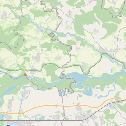
| Name | Leidling (name)
|
| Type | landuse:residential |
| Last Updated | 2018-12-03 20:01 |
| Admin Level | 15 |
| Rank | Croft / Farm / Locality / Islet |
| Importance | 0.2 (estimated) |
| Coverage | Polygon |
| Centre Point | 48.69468595,11.077605996058 |
| OSM | way 379919857 |
| Computed Postcode | 86666 |
| Address Tags | |
| Extra Tags |
| Local name | Type | OSM | Address rank | Admin level | Distance | |
| Leidling | landuse:residential | way 379919857 | 22 | 0 | details > | |
| Burgheim | place:village | relation 943668 | 16 | 8 | 0 | details > |
| Leidling | place:village | node 535113316 | 16 | 0 | details > | |
| Biding | place:village | node 397798619 | 16 | 0 | details > | |
| Landkreis Neuburg-Schrobenhausen | boundary:administrative | relation 62655 | 12 | 6 | 0 | details > |
| Obb | boundary:administrative | relation 2145274 | 10 | 5 | 0 | details > |
| Bayern | place:state | relation 2145268 | 8 | 4 | 0 | details > |
| 86666 | place:postcode | 5 | 0 | |||
| 86666 | place:postcode | relation 1142092 | 5 | 0 | details > | |
| Deutschland | place:country | relation 51477 | 4 | 2 | ~3 m | details > |
| de | place:country_code | 4 | 0 | |||
Parent Of | ||||||
Unclassified | ||||||
| Bidinger Straße | highway:unclassified | way 71234425 | 26 | ~106 m | details > | |
| No Name | highway:unclassified | way 81164337 | 26 | ~145 m | details > | |
Secondary | ||||||
| St 2050 | highway:secondary | way 503185785 | 26 | ~106 m | details > | |
| St 2050 | highway:secondary | way 131348595 | 26 | ~16 m | details > | |
Residential | ||||||
| No Name | highway:residential | way 544200839 | 26 | ~90 m | details > | |
| No Name | highway:residential | way 544200841 | 26 | ~33 m | details > | |
| No Name | highway:residential | way 95560077 | 26 | ~17 m | details > | |
| No Name | highway:residential | way 95558786 | 26 | ~62 m | details > | |