| Name | Aldinger Straße (name)
Aldinger Straße (name:de)
K 1692 (ref)
|
| Type | highway:secondary |
| Last Updated | 2018-12-04 18:05 |
| Admin Level | 15 |
| Rank | Street / Major Landmark |
| Importance | 0.1 (estimated) |
| Coverage | Polygon |
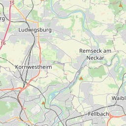
| Centre Point | 48.881173,9.21574889355395 |
| OSM | way 388148680 |
| Computed Postcode | 71638 |
| Address Tags | |
| Extra Tags | 1 (lanes)
50 (maxspeed)
asphalt (surface)
6 (width)
|
| Local name | Type | OSM | Address rank | Admin level | Distance | |
| Aldinger Straße | highway:secondary | way 388148680 | 26 | 0 | details > | |
| Grünbühl | place:neighbourhood | node 1613502359 | 22 | 0 | details > | |
| Grünbühl-Sonnenberg | place:suburb | relation 6717770 | 20 | 10 | 0 | details > |
| Ludwigsburg | place:town | relation 405292 | 16 | 8 | 0 | details > |
| Landkreis Ludwigsburg | boundary:administrative | relation 62536 | 12 | 6 | 0 | details > |
| Regierungsbezirk Stuttgart | boundary:administrative | relation 22041 | 10 | 5 | 0 | details > |
| Baden-Württemberg | place:state | relation 62611 | 8 | 4 | 0 | details > |
| 71638 | place:postcode | 5 | 0 | |||
| 71638 | place:postcode | relation 1247098 | 5 | 0 | details > | |
| Deutschland | place:country | relation 51477 | 4 | 2 | ~3 m | details > |
| de | place:country_code | 4 | 0 | |||
Parent Of | ||||||
Street_lamp | ||||||
| No Name | highway:street_lamp | node 6030553723 | 30 | ~23 m | details > | |
| No Name | highway:street_lamp | node 6030553725 | 30 | ~24 m | details > | |
| No Name | highway:street_lamp | node 6030553715 | 30 | ~23 m | details > | |
| No Name | highway:street_lamp | node 6030553724 | 30 | ~27 m | details > | |
Give_way | ||||||
| No Name | highway:give_way | node 6030494700 | 30 | ~22 m | details > | |