| Name | Groitzschen (name)
|
| Type | place:suburb |
| Last Updated | 2018-12-03 18:29 |
| Admin Level | 15 |
| Rank | Suburb |
| Importance | 0.25 (estimated) |
| Coverage | Polygon |
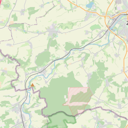
| Centre Point | 51.06451,12.0811524 |
| OSM | way 402147464 |
| Computed Postcode | |
| Address Tags | |
| Extra Tags | suburb (place)
|
| Local name | Type | OSM | Address rank | Admin level | Distance | |
| Groitzschen | place:suburb | way 402147464 | 20 | 0 | details > | |
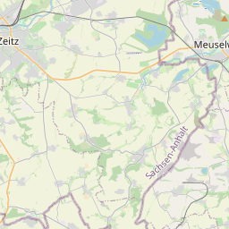
| Kretzschau | place:village | relation 2404547 | 16 | 8 | 0 | details > |
| Droyßiger-Zeitzer Forst | boundary:administrative | relation 2404545 | 14 | 7 | 0 | details > |
| Burgenlandkreis | place:county | relation 62639 | 12 | 6 | 0 | details > |
| Sachsen-Anhalt | place:state | relation 62607 | 8 | 4 | ~1 m | details > |
| Deutschland | place:country | relation 51477 | 4 | 2 | ~2 m | details > |
| de | place:country_code | 4 | 0 | |||
Linked Places | ||||||
| Groitzschen | place:suburb | node 1528148700 | 20 | 0 | details > | |
Parent Of | ||||||
Park | ||||||
| No Name | leisure:park | relation 2647238 | 0 | ~80 m | details > | |
Track | ||||||
| Altes Werk | highway:track | way 138209106 | 26 | ~354 m | details > | |
Residential | ||||||
| An der Ziegelei | highway:residential | way 137877750 | 26 | ~277 m | details > | |
| An der Ziegelei | highway:residential | way 137877748 | 26 | ~266 m | details > | |
| Dorflage | highway:residential | way 455370841 | 26 | ~192 m | details > | |
| Dorflage | highway:residential | way 121589356 | 26 | ~202 m | details > | |
| Dorflage | highway:residential | way 108019114 | 26 | ~160 m | details > | |
| Dorflage | highway:residential | way 35387853 | 26 | ~70 m | details > | |
| Dorflage | highway:residential | way 108046194 | 26 | ~202 m | details > | |
| Dorflage | highway:residential | way 108014076 | 26 | ~186 m | details > | |
| Leipziger Straße | highway:residential | way 398138366 | 26 | ~192 m | details > | |
Unclassified | ||||||
| Dorflage | highway:unclassified | way 136335976 | 26 | ~197 m | details > | |
| Dorflage | highway:unclassified | way 234931406 | 26 | ~160 m | details > | |