| Name | B 15 (ref)
|
| Type | highway:primary |
| Last Updated | 2018-12-04 07:27 |
| Admin Level | 15 |
| Rank | Street / Major Landmark |
| Importance | 0.1 (estimated) |
| Coverage | Point |
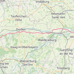
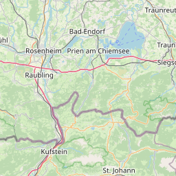
| Centre Point | 47.962791,12.1290521 |
| OSM | way 528193353 |
| Computed Postcode | 83135 |
| Address Tags | |
| Extra Tags | 3 (lanes)
80 (maxspeed)
asphalt (surface)
|
| Local name | Type | OSM | Address rank | Admin level | Distance | |
| B 15 | highway:primary | way 528193353 | 26 | 0 | details > | |
| Rottmoos | place:isolated_dwelling | node 4391802724 | 20 | 0 | details > | |
| Hagenrain | place:isolated_dwelling | node 537535442 | 20 | 0 | details > | |
| Untersaurain | place:isolated_dwelling | node 4391802725 | 20 | 0 | details > | |
| Schechen | place:village | relation 2186940 | 16 | 8 | 0 | details > |
| Geharting | place:hamlet | node 506175857 | 16 | 0 | details > | |
| Dobl | place:hamlet | node 2449312863 | 16 | 0 | details > | |
| Oberwöhrn | place:hamlet | node 257419778 | 16 | 0 | details > | |
| Ritzmehring | place:hamlet | node 4826028178 | 16 | 0 | details > | |
| Friesing | place:hamlet | node 262289976 | 16 | 0 | details > | |
| Unterwöhrn | place:hamlet | node 259412550 | 16 | 0 | details > | |
| Lengdorf | place:hamlet | node 56489148 | 16 | 0 | details > | |
| Sargau | place:hamlet | node 259839137 | 16 | 0 | details > | |
| Frauenöd | place:hamlet | node 259839134 | 16 | 0 | details > | |
| Weiher | place:hamlet | node 262289978 | 16 | 0 | details > | |
| Gigling | place:hamlet | node 2482865350 | 16 | 0 | details > | |
| Rottmühle | place:hamlet | node 257419777 | 16 | 0 | details > | |
| Feldkirchen | place:hamlet | node 259412551 | 16 | 0 | details > | |
| Hart | place:village | node 2482865351 | 16 | 0 | details > | |
| Landkreis Rosenheim | place:county | relation 2156362 | 12 | 6 | 0 | details > |
| Obb | boundary:administrative | relation 2145274 | 10 | 5 | 0 | details > |
| Bayern | place:state | relation 2145268 | 8 | 4 | ~1 m | details > |
| 83135 | place:postcode | 5 | 0 | |||
| 83135 | place:postcode | relation 1114551 | 5 | 0 | details > | |
| Deutschland | place:country | relation 51477 | 4 | 2 | ~4 m | details > |
| de | place:country_code | 4 | 0 | |||
Parent Of | ||||||
Bus_stop | ||||||
| Mauth, Feldkirchen Abzw | highway:bus_stop | node 5431734305 | 30 | ~15 m | details > | |