| Name | Alte Landstraße (name)
Alte Landstraße (name:de)
L 194 (ref)
|
| Type | highway:secondary |
| Last Updated | 2018-12-04 11:19 |
| Admin Level | 15 |
| Rank | Street / Major Landmark |
| Importance | 0.1 (estimated) |
| Coverage | Point |
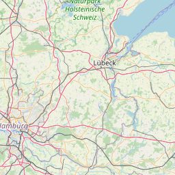
| Centre Point | 54.3418355,10.0296719 |
| OSM | way 541721917 |
| Computed Postcode | 24107 |
| Address Tags | |
| Extra Tags | 70 (maxspeed)
asphalt (surface)
|
| Local name | Type | OSM | Address rank | Admin level | Distance | |
| Alte Landstraße | highway:secondary | way 541721917 | 26 | 0 | details > | |
| Rögen | place:isolated_dwelling | node 5123730118 | 20 | 0 | details > | |
| Quarnbek | place:village | relation 548499 | 16 | 8 | 0 | details > |
| Stampe | place:village | node 193604855 | 16 | 0 | details > | |
| Achterwehr | boundary:administrative | relation 1445662 | 14 | 7 | 0 | details > |
| Rendsburg-Eckernförde | place:county | relation 27017 | 12 | 6 | 0 | details > |
| Schleswig-Holstein | place:state | relation 51529 | 8 | 4 | 0 | details > |
| 24107 | place:postcode | 5 | 0 | |||
| 24107 | place:postcode | relation 1206204 | 5 | 0 | details > | |
| Deutschland | place:country | relation 51477 | 4 | 2 | ~3 m | details > |
| de | place:country_code | 4 | 0 | |||
Parent Of | ||||||
Bus_stop | ||||||
| Stampe Wiederkamp | highway:bus_stop | node 559767220 | 30 | ~78 m | details > | |
| Stampe Wiederkamp | highway:bus_stop | node 347345896 | 30 | ~109 m | details > | |