| Name | Oberstenfelder Straße (name)
Oberstenfelder Straße (name:de)
L 1118 (ref)
|
| Type | highway:tertiary |
| Last Updated | 2018-12-04 17:59 |
| Admin Level | 15 |
| Rank | Street / Major Landmark |
| Importance | 0.1 (estimated) |
| Coverage | Point |
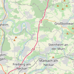
| Centre Point | 48.9905723,9.3613709 |
| OSM | way 544559230 |
| Computed Postcode | 71546 |
| Address Tags | |
| Extra Tags | 2 (lanes)
50 (maxspeed)
excellent (smoothness)
asphalt (surface)
|
| Local name | Type | OSM | Address rank | Admin level | Distance | |
| Oberstenfelder Straße | highway:tertiary | way 544559230 | 26 | 0 | details > | |
| Föhrenberg | place:neighbourhood | node 3693108526 | 22 | 0 | details > | |
| Hintervöhrenberg | place:isolated_dwelling | node 1293687353 | 20 | 0 | details > | |
| Vordervöhrenberg | place:isolated_dwelling | node 1293688142 | 20 | 0 | details > | |
| Kleinaspach | place:village | way 32248122 | 16 | 0 | details > | |
| Aspach | boundary:administrative | relation 400932 | 16 | 8 | 0 | details > |
| Vereinbarte Verwaltungsgemeinschaft der Stadt Backnang | boundary:administrative | relation 1613874 | 14 | 7 | 0 | details > |
| Rems-Murr-Kreis | place:county | relation 62412 | 12 | 6 | 0 | details > |
| Regierungsbezirk Stuttgart | boundary:administrative | relation 22041 | 10 | 5 | 0 | details > |
| Baden-Württemberg | place:state | relation 62611 | 8 | 4 | 0 | details > |
| 71546 | place:postcode | 5 | 0 | |||
| 71546 | place:postcode | relation 3378274 | 5 | 0 | details > | |
| Deutschland | place:country | relation 51477 | 4 | 2 | ~3 m | details > |
| de | place:country_code | 4 | 0 | |||
Parent Of | ||||||
Restaurant | ||||||
| Gasthof Krone - Dorfstüble | amenity:restaurant | node 221083708 | 30 | ~18 m | details > | |
House | ||||||
| No Name | place:house | node 5418826739 | 30 | ~62 m | details > | |
| No Name | place:house | node 5418826743 | 30 | ~31 m | details > | |
| No Name | place:house | node 5418826741 | 30 | ~28 m | details > | |
| No Name | place:house | node 5418826740 | 30 | ~32 m | details > | |
Building | ||||||
| No Name | building:yes | way 191722614 | 30 | ~34 m | details > | |
Parking | ||||||
| No Name | amenity:parking | way 498624932 | 30 | ~5 m | details > | |