| Name | St 2104 (ref)
|
| Type | highway:secondary |
| Last Updated | 2018-12-04 02:38 |
| Admin Level | 15 |
| Rank | Street / Major Landmark |
| Importance | 0.1 (estimated) |
| Coverage | Point |
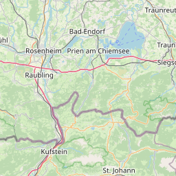
| Centre Point | 47.9724412,12.5825336 |
| OSM | way 546395420 |
| Computed Postcode | 83368 |
| Address Tags | |
| Extra Tags | use_sidepath (foot)
3 (lanes)
100 (maxspeed)
asphalt (surface)
|
| Local name | Type | OSM | Address rank | Admin level | Distance | |
| St 2104 | highway:secondary | way 546395420 | 26 | 0 | details > | |
| Traunreut | place:town | relation 941741 | 16 | 8 | 0 | details > |
| Hochreit | place:hamlet | node 440965417 | 16 | 0 | details > | |
| Weisbrunn | place:village | node 439752702 | 16 | 0 | details > | |
| Landkreis Traunstein | boundary:administrative | relation 2156363 | 12 | 6 | 0 | details > |
| Obb | boundary:administrative | relation 2145274 | 10 | 5 | 0 | details > |
| Bayern | place:state | relation 2145268 | 8 | 4 | ~2 m | details > |
| 83368 | place:postcode | 5 | 0 | |||
| 83368 | place:postcode | relation 1114757 | 5 | 0 | details > | |
| Deutschland | place:country | relation 51477 | 4 | 2 | ~4 m | details > |
| de | place:country_code | 4 | 0 | |||
Parent Of | ||||||
Works | ||||||
| No Name | man_made:works | way 254104795 | 30 | ~114 m | details > | |