| Name | Buttenmühle (name)
|
| Type | highway:service |
| Last Updated | 2018-12-05 14:54 |
| Admin Level | 15 |
| Rank | Minory Street / Path |
| Importance | 0.075 (estimated) |
| Coverage | Point |
| Centre Point | 47.8100369,9.5224603 |
| OSM | way 550655991 |
| Computed Postcode | 88213 |
| Address Tags | |
| Extra Tags |
| Local name | Type | OSM | Address rank | Admin level | Distance | |
| Buttenmühle | highway:service | way 550655991 | 27 | 0 | details > | |
| Zuberg | place:isolated_dwelling | node 5501976475 | 20 | 0 | details > | |
| Buttenmühle | place:hamlet | way 234229223 | 16 | 0 | details > | |
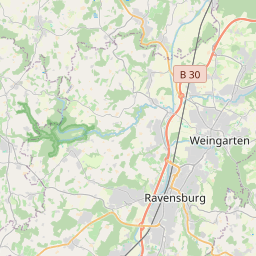
| Ravensburg | place:city | relation 2808301 | 16 | 8 | 0 | details > |
| Verwaltungsverband Mittleres Schussental | boundary:administrative | relation 2951923 | 14 | 7 | 0 | details > |
| Landkreis Ravensburg | place:county | relation 2808774 | 12 | 6 | 0 | details > |
| Regierungsbezirk Tübingen | boundary:administrative | relation 2811874 | 10 | 5 | 0 | details > |
| Baden-Württemberg | place:state | relation 62611 | 8 | 4 | 0 | details > |
| 88213 | place:postcode | 5 | 0 | |||
| 88213 | place:postcode | relation 1112058 | 5 | 0 | details > | |
| Deutschland | place:country | relation 51477 | 4 | 2 | ~4 m | details > |
| de | place:country_code | 4 | 0 | |||
Parent Of | ||||||
Tree | ||||||
| Königstanne | natural:tree | node 1348011190 | 30 | ~417 m | details > | |
Information | ||||||
| Naturschutzgebiet Schmalegger und Ringgenburger Tobel | tourism:information | node 2389866308 | 30 | ~475 m | details > | |
| No Name | tourism:information | node 3516589043 | 30 | ~272 m | details > | |
Building | ||||||
| No Name | building:yes | way 152507710 | 30 | ~55 m | details > | |
Wayside_cross | ||||||
| No Name | historic:wayside_cross | node 2389866322 | 30 | ~475 m | details > | |