| Name | |
| Type | highway:unclassified |
| Last Updated | 2018-12-04 13:45 |
| Admin Level | 15 |
| Rank | Street / Major Landmark |
| Importance | 0.1 (estimated) |
| Coverage | Point |
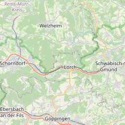
| Centre Point | 48.8560916,9.5756495 |
| OSM | way 605924202 |
| Computed Postcode | 73635 |
| Address Tags | |
| Extra Tags | 30 (maxspeed)
2.5 (maxweight)
asphalt (surface)
|
| Local name | Type | OSM | Address rank | Admin level | Distance | |
| No Name | highway:unclassified | way 605924202 | 26 | 0 | details > | |
| Berghof | place:isolated_dwelling | node 5356883972 | 20 | 0 | details > | |
| Untere Bausche | place:isolated_dwelling | node 305587930 | 20 | 0 | details > | |
| Obere Bausche | place:isolated_dwelling | node 305587533 | 20 | 0 | details > | |
| Buchäcker | place:isolated_dwelling | node 5469842268 | 20 | 0 | details > | |
| Rudersberg | place:village | relation 401647 | 16 | 8 | 0 | details > |
| Welzheim | place:town | relation 401624 | 16 | 8 | 0 | details > |
| Steinbruck | place:hamlet | node 267216924 | 16 | 0 | details > | |
| Eselshalden | place:hamlet | node 250100680 | 16 | 0 | details > | |
| Obersteinenberg | place:hamlet | node 256062531 | 16 | 0 | details > | |
| Taubenhof | place:hamlet | node 291649276 | 16 | 0 | details > | |
| Vereinbarte Verwaltungsgemeinschaft der Stadt Welzheim | boundary:administrative | relation 1613884 | 14 | 7 | 0 | details > |
| Rems-Murr-Kreis | place:county | relation 62412 | 12 | 6 | 0 | details > |
| Regierungsbezirk Stuttgart | boundary:administrative | relation 22041 | 10 | 5 | 0 | details > |
| Baden-Württemberg | place:state | relation 62611 | 8 | 4 | 0 | details > |
| 73635 | place:postcode | 5 | 0 | |||
| 73642 | place:postcode | relation 3325205 | 5 | 0 | details > | |
| 73635 | place:postcode | relation 3377944 | 5 | 0 | details > | |
| Deutschland | place:country | relation 51477 | 4 | 2 | ~3 m | details > |
| de | place:country_code | 4 | 0 |