| Name | Pechau (name)
|
| Type | boundary:administrative |
| Last Updated | 2018-12-03 17:23 |
| Admin Level | 9 |
| Rank | Village / Hamlet |
| Importance | 0.3 (estimated) |
| Coverage | Polygon |
| Centre Point | 52.08425725,11.7244760573164 |
| OSM | relation 84149 |
| Computed Postcode | |
| Address Tags | |
| Extra Tags | Q282044 (wikidata)
de:Pechau (wikipedia)
|
| Local name | Type | OSM | Address rank | Admin level | Distance | |
| Pechau | boundary:administrative | relation 84149 | 18 | 9 | 0 | details > |
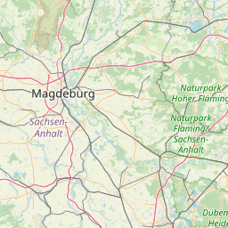
| Magdeburg | place:city | relation 62481 | 12 | 6 | 0 | details > |
| Sachsen-Anhalt | place:state | relation 62607 | 8 | 4 | 0 | details > |
| Deutschland | place:country | relation 51477 | 4 | 2 | ~2 m | details > |
| de | place:country_code | 4 | 0 | |||
Parent Of | ||||||
Plant_nursery | ||||||
| Baumschule Gustav Beyme | landuse:plant_nursery | way 161431836 | 0 | ~1.1 km | details > | |
Forest | ||||||
| Pechauer Busch | landuse:forest | relation 7304859 | 0 | ~1.7 km | details > | |
Postcode | ||||||
| 39114 | place:postcode | node 4752907230 | 11 | ~716 m | details > | |
| 39114 | place:postcode | node 4752907229 | 11 | ~700 m | details > | |
| 39114 | place:postcode | node 4752907234 | 11 | ~738 m | details > | |
| 39114 | place:postcode | node 4752907231 | 11 | ~708 m | details > | |
| 39114 | place:postcode | node 4752907233 | 11 | ~723 m | details > | |
| 39114 | place:postcode | node 4752907232 | 11 | ~730 m | details > | |
Village | ||||||
| Pechau | place:village | node 2498561517 | 16 | ~786 m | details > | |
Residential | ||||||
| Brückbusch | landuse:residential | way 30534424 | 22 | ~340 m | details > | |
| Luisenthal | landuse:residential | way 30535269 | 22 | ~556 m | details > | |
| Am Kanal | highway:residential | way 27692802 | 26 | ~740 m | details > | |
| Am See | highway:residential | way 36892847 | 26 | ~679 m | details > | |
| Am See | highway:residential | way 442898025 | 26 | ~972 m | details > | |
| Breite Straße | highway:residential | way 197085139 | 26 | ~561 m | details > | |
| Breite Straße | highway:residential | way 27692594 | 26 | ~769 m | details > | |
| Breite Straße | highway:residential | way 29089304 | 26 | ~774 m | details > | |
| Breite Straße | highway:residential | way 29089303 | 26 | ~791 m | details > | |
| Breite Straße | highway:residential | way 27692578 | 26 | ~798 m | details > | |
| Breite Straße | highway:residential | way 27692580 | 26 | ~540 m | details > | |
| Hauptstraße | highway:residential | way 40322771 | 26 | ~857 m | details > | |
| Hauptstraße | highway:residential | way 29089298 | 26 | ~791 m | details > | |
| Hauptstraße | highway:residential | way 40322770 | 26 | ~861 m | details > | |
| Seehof | highway:residential | way 36892515 | 26 | ~972 m | details > | |
| Zur Mühle | highway:residential | way 27692809 | 26 | ~945 m | details > | |
| Zur Mühle | highway:residential | way 560359867 | 26 | ~861 m | details > | |
| Zur Mühle | highway:residential | way 27692807 | 26 | ~998 m | details > | |
| Zur Mühle | highway:residential | way 27692805 | 26 | ~945 m | details > | |
| No Name | highway:residential | way 36892849 | 26 | ~921 m | details > | |
Track | ||||||
| Am Kanal | highway:track | way 98503131 | 26 | ~658 m | details > | |
| Am Kanal | highway:track | way 27694342 | 26 | ~658 m | details > | |
| Am Kanal | highway:track | way 27694343 | 26 | ~660 m | details > | |
| Klusdamm Radweg | highway:track | way 60656010 | 26 | ~827 m | details > | |
| Klusdamm Radweg | highway:track | way 601337941 | 26 | ~1 km | details > | |
| Klusdamm Radweg | highway:track | way 442898026 | 26 | ~998 m | details > | |
Tertiary | ||||||
| Calenberger Straße | highway:tertiary | way 165263944 | 26 | ~1 km | details > | |
| Calenberger Straße | highway:tertiary | way 8597114 | 26 | ~400 m | details > | |
| Calenberger Straße | highway:tertiary | way 170663540 | 26 | ~1.1 km | details > | |
Path | ||||||
| Am Siel | highway:path | way 36469153 | 27 | ~128 m | details > | |
| Dreibogenbrücke | highway:path | way 60102050 | 27 | ~2.3 km | details > | |
| Klusdamm Radweg | highway:path | way 70240797 | 27 | ~828 m | details > | |