| Name | Friedrich-Wilhelm-Lübke-Koog (name)
|
| Type | boundary:administrative |
| Last Updated | 2018-12-03 15:05 |
| Admin Level | 8 |
| Rank | City |
| Importance | 0.35 (estimated) |
| Coverage | Polygon |
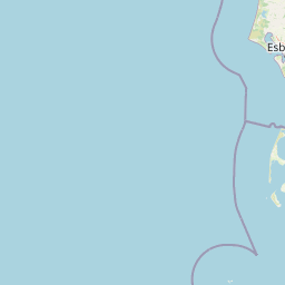
| Centre Point | 54.8630124,8.6295679 |
| OSM | relation 1418657 |
| Computed Postcode | |
| Address Tags | |
| Extra Tags | village (place)
160 (population)
Q559472 (wikidata)
de:Friedrich-Wilhelm-Lübke-Koog (wikipedia)
|
| Local name | Type | OSM | Address rank | Admin level | Distance | |
| Friedrich-Wilhelm-Lübke-Koog | boundary:administrative | relation 1418657 | 16 | 8 | 0 | details > |
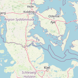
| Südtondern | boundary:administrative | relation 1574208 | 14 | 7 | 0 | details > |
| Nordfriesland | place:county | relation 27019 | 12 | 6 | 0 | details > |
| Schleswig-Holstein | place:state | relation 51529 | 8 | 4 | ~1 m | details > |
| Deutschland | place:country | relation 51477 | 4 | 2 | ~4 m | details > |
| de | place:country_code | 4 | 0 | |||
Linked Places | ||||||
| Friedrich-Wilhelm-Lübke-Koog | place:village | node 240074898 | 16 | 0 | details > | |
Parent Of | ||||||
Unclassified | ||||||
| Althorsbüll | highway:unclassified | way 29319655 | 26 | ~3.7 km | details > | |
| Kirchenweg | highway:unclassified | way 443365040 | 26 | ~3 km | details > | |
| Klanxbüller Weg | highway:unclassified | way 29319663 | 26 | ~742 m | details > | |
| Rentoftstraße | highway:unclassified | way 29319666 | 26 | ~742 m | details > | |
| Schleusenweg | highway:unclassified | way 99484107 | 26 | ~2.2 km | details > | |
| Wellumweg | highway:unclassified | way 99478583 | 26 | ~42 m | details > | |
| Wellumweg | highway:unclassified | way 481229564 | 26 | ~211 m | details > | |
| Wippenbüller Weg | highway:unclassified | way 99484405 | 26 | ~1.5 km | details > | |
| No Name | highway:unclassified | way 113266339 | 26 | ~764 m | details > | |
| No Name | highway:unclassified | way 481229565 | 26 | ~2.1 km | details > | |
| No Name | highway:unclassified | way 99484407 | 26 | ~1.1 km | details > | |
| No Name | highway:unclassified | way 99484403 | 26 | ~817 m | details > | |
| No Name | highway:unclassified | way 99305787 | 26 | ~1.4 km | details > | |
| No Name | highway:unclassified | way 99484109 | 26 | ~3.6 km | details > | |
| No Name | highway:unclassified | way 99478586 | 26 | ~2 km | details > | |
| No Name | highway:unclassified | way 29319648 | 26 | ~2.8 km | details > | |
| No Name | highway:unclassified | way 82666886 | 26 | ~2.1 km | details > | |
Tertiary | ||||||
| Horsbüller Weg | highway:tertiary | way 443364869 | 26 | ~2.8 km | details > | |
| Klanxbüller Weg | highway:tertiary | way 29319662 | 26 | ~684 m | details > | |
| Rentoftstraße | highway:tertiary | way 99484102 | 26 | ~817 m | details > | |
| Rentoftstraße | highway:tertiary | way 113266331 | 26 | ~289 m | details > | |
| Zur Stöpe | highway:tertiary | way 29319660 | 26 | ~3.1 km | details > | |
Track | ||||||
| Wellumweg | highway:track | way 481229563 | 26 | ~804 m | details > | |
Residential | ||||||
| No Name | highway:residential | way 443528649 | 26 | ~362 m | details > | |
| No Name | highway:residential | way 99835703 | 26 | ~91 m | details > | |