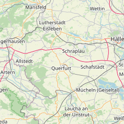
| Name | Grockstädt (name)
|
| Type | boundary:administrative |
| Last Updated | 2018-12-03 18:29 |
| Admin Level | 10 |
| Rank | Suburb |
| Importance | 0.25 (estimated) |
| Coverage | Polygon |
| Centre Point | 51.32852895,11.5543684279708 |
| OSM | relation 2406563 |
| Computed Postcode | |
| Address Tags | |
| Extra Tags | Ortsteil (name:prefix)
Q2587419 (wikidata)
nl:Grockstädt (wikipedia)
|
| Local name | Type | OSM | Address rank | Admin level | Distance | |
| Grockstädt | boundary:administrative | relation 2406563 | 20 | 10 | 0 | details > |
| Querfurt | place:town | relation 2396173 | 16 | 8 | 0 | details > |
| Kleineichstädt | place:village | node 308947801 | 16 | 0 | details > | |
| Saalekreis | boundary:administrative | relation 62473 | 12 | 6 | 0 | details > |
| Sachsen-Anhalt | place:state | relation 62607 | 8 | 4 | 0 | details > |
| Deutschland | place:country | relation 51477 | 4 | 2 | ~1 m | details > |
| de | place:country_code | 4 | 0 | |||
Parent Of | ||||||
Meadow | ||||||
| Hundewiese | landuse:meadow | way 235265294 | 0 | ~2.7 km | details > | |
Park | ||||||
| No Name | leisure:park | way 422299597 | 0 | ~351 m | details > | |
Primary | ||||||
| B 250 | highway:primary | way 180591152 | 26 | ~1.3 km | details > | |
Residential | ||||||
| Bergstraße | highway:residential | way 187938585 | 26 | ~170 m | details > | |
| Friedhofsstraße | highway:residential | way 625774646 | 26 | ~2.3 km | details > | |
| Rosa-Luxemburg-Straße | highway:residential | way 133829552 | 26 | ~2.2 km | details > | |
| Rosa-Luxemburg-Straße | highway:residential | way 181149705 | 26 | ~2.4 km | details > | |
| Rosa-Luxemburg-Straße | highway:residential | way 133829561 | 26 | ~2.5 km | details > | |
| Schmoner Straße | highway:residential | way 33230027 | 26 | ~388 m | details > | |
| Schmoner Straße | highway:residential | way 173425066 | 26 | ~314 m | details > | |
| Schmoner Straße | highway:residential | way 33230062 | 26 | ~426 m | details > | |
| Schulgasse | highway:residential | way 625774645 | 26 | ~2.4 km | details > | |
| Siedlung | highway:residential | way 181149702 | 26 | ~2.3 km | details > | |
| Straße der Freundschaft | highway:residential | way 38503089 | 26 | ~1.8 km | details > | |
| Straße der Freundschaft | highway:residential | way 181150380 | 26 | ~1.5 km | details > | |
| Straße der Freundschaft | highway:residential | way 181150383 | 26 | ~1.8 km | details > | |
| Straße des Aufbaus | highway:residential | way 187938577 | 26 | ~157 m | details > | |
| Straße des Aufbaus | highway:residential | way 33230034 | 26 | ~157 m | details > | |
| Straße des Friedens | highway:residential | way 173425064 | 26 | ~264 m | details > | |
| Straße des Friedens | highway:residential | way 33230052 | 26 | ~157 m | details > | |
| Teichstraße | highway:residential | way 33230096 | 26 | ~285 m | details > | |
| Teichstraße | highway:residential | way 187938579 | 26 | ~297 m | details > | |
| Ziegelrodaer Straße | highway:residential | way 172441265 | 26 | ~243 m | details > | |
| Ziegelrodaer Straße | highway:residential | way 386876599 | 26 | ~234 m | details > | |
| No Name | highway:residential | way 181149703 | 26 | ~2.5 km | details > | |
| No Name | highway:residential | way 33229994 | 26 | ~242 m | details > | |
| No Name | highway:residential | way 33230020 | 26 | ~264 m | details > | |
| No Name | highway:residential | way 223687979 | 26 | ~253 m | details > | |
| No Name | highway:residential | way 223687980 | 26 | ~238 m | details > | |
| No Name | highway:residential | way 187938573 | 26 | ~182 m | details > | |
| No Name | highway:residential | way 181149708 | 26 | ~2.4 km | details > | |
| No Name | highway:residential | way 181149706 | 26 | ~2.5 km | details > | |
| No Name | highway:residential | way 133868030 | 26 | ~1.7 km | details > | |
| No Name | highway:residential | way 33230070 | 26 | ~177 m | details > | |
| No Name | highway:residential | way 173425063 | 26 | ~246 m | details > | |
Tertiary | ||||||
| K 2676 | highway:tertiary | way 33230004 | 26 | ~329 m | details > | |
| K 2677 | highway:tertiary | way 133829565 | 26 | ~1.9 km | details > | |
| Karl-Marx-Straße | highway:tertiary | way 33230043 | 26 | ~138 m | details > | |
| Ziegelrodaer Straße | highway:tertiary | way 386876600 | 26 | ~234 m | details > | |
Track | ||||||
| Kleineichstädter Weg | highway:track | way 173598083 | 26 | ~2.4 km | details > | |
| Schmoner Straße; Teichstraße | highway:track | way 422295847 | 26 | ~388 m | details > | |
| Weißenschirmbacher Straße | highway:track | way 173598091 | 26 | ~3.1 km | details > | |
Living_street | ||||||
| Ringstraße | highway:living_street | way 181150382 | 26 | ~1.7 km | details > | |
Unclassified | ||||||
| Ziegelrodaer Straße | highway:unclassified | way 33229990 | 26 | ~243 m | details > | |
| Ziegelrodaer Straße | highway:unclassified | way 173598092 | 26 | ~438 m | details > | |
| No Name | highway:unclassified | way 226932422 | 26 | ~518 m | details > | |
| No Name | highway:unclassified | way 226932427 | 26 | ~382 m | details > | |
| No Name | highway:unclassified | way 33230067 | 26 | ~442 m | details > | |
| No Name | highway:unclassified | way 133829563 | 26 | ~2.4 km | details > | |
Service | ||||||
| Befgstraße | highway:service | way 187938572 | 27 | ~325 m | details > | |
| Marktweg | highway:service | way 235265309 | 27 | ~1.8 km | details > | |
| Rosa-Luxemburg-Straße | highway:service | way 305846709 | 27 | ~2.4 km | details > | |