| Name | Ottmarsheimer Höhe (name)
|
| Type | landuse:industrial |
| Last Updated | 2018-12-03 20:42 |
| Admin Level | 15 |
| Rank | Croft / Farm / Locality / Islet |
| Importance | 0.2 (estimated) |
| Coverage | Polygon |
| Centre Point | 49.0122962,9.2121699333861 |
| OSM | relation 3074189 |
| Computed Postcode | 74354 |
| Address Tags | |
| Extra Tags |
| Local name | Type | OSM | Address rank | Admin level | Distance | |
| Ottmarsheimer Höhe | landuse:industrial | relation 3074189 | 22 | 0 | details > | |
| Talhof | place:isolated_dwelling | node 5320491645 | 20 | 0 | details > | |
| Sonnenhof | place:isolated_dwelling | node 5320491646 | 20 | 0 | details > | |
| Heckenhof | place:isolated_dwelling | node 5320491644 | 20 | 0 | details > | |
| Siehdichfür | place:isolated_dwelling | node 4677999969 | 20 | 0 | details > | |
| Saalenhof | place:isolated_dwelling | node 5365537159 | 20 | 0 | details > | |
| Riedernhöfe | place:isolated_dwelling | node 3184691515 | 20 | 0 | details > | |
| Lindenhof | place:isolated_dwelling | node 5365537154 | 20 | 0 | details > | |
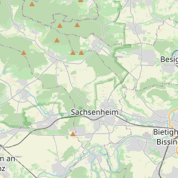
| Besigheim | place:town | relation 405302 | 16 | 8 | 0 | details > |
| Ottmarsheim | place:village | node 272488626 | 16 | 0 | details > | |
| Gemeindeverwaltungsverband Besigheim | boundary:administrative | relation 1613515 | 14 | 7 | 0 | details > |
| Landkreis Ludwigsburg | boundary:administrative | relation 62536 | 12 | 6 | 0 | details > |
| Regierungsbezirk Stuttgart | boundary:administrative | relation 22041 | 10 | 5 | 0 | details > |
| Baden-Württemberg | place:state | relation 62611 | 8 | 4 | 0 | details > |
| 74354 | place:postcode | 5 | 0 | |||
| 74354 | place:postcode | relation 1227789 | 5 | 0 | details > | |
| Deutschland | place:country | relation 51477 | 4 | 2 | ~3 m | details > |
| de | place:country_code | 4 | 0 | |||
Parent Of | ||||||
Residential | ||||||
| Carl-Benz-Straße | highway:residential | way 42741861 | 26 | ~332 m | details > | |
| Carl-Benz-Straße | highway:residential | way 49870086 | 26 | ~205 m | details > | |
| Carl-Benz-Straße | highway:residential | way 176600256 | 26 | ~344 m | details > | |
| Carl-Benz-Straße | highway:residential | way 176600253 | 26 | ~260 m | details > | |
| Carl-Benz-Straße;Kreuzäckerstraße | highway:residential | way 176600282 | 26 | ~332 m | details > | |
| Carl-Zeiss-Straße | highway:residential | way 42741854 | 26 | ~230 m | details > | |
| Carl-Zeiss-Straße | highway:residential | way 149744027 | 26 | ~152 m | details > | |
| Ferdinand-Porsche-Straße | highway:residential | way 42741860 | 26 | ~24 m | details > | |
| Heinrich-Hertz-Straße | highway:residential | way 42741853 | 26 | ~213 m | details > | |
| Heinrich-Hertz-Straße | highway:residential | way 42741851 | 26 | ~298 m | details > | |
| Johannes-Kepler-Straße | highway:residential | way 42741858 | 26 | ~174 m | details > | |
| Max-Eyth-Straße | highway:residential | way 42741857 | 26 | ~120 m | details > | |
| Rudolf-Diesel-Straße | highway:residential | way 42741859 | 26 | ~230 m | details > | |
| Rudolf-Diesel-Straße | highway:residential | way 49870085 | 26 | ~230 m | details > | |
| Rudolf-Diesel-Straße | highway:residential | way 42741888 | 26 | ~255 m | details > | |
| Wilhelm-Maybach-Straße | highway:residential | way 42741850 | 26 | ~115 m | details > | |