| Name | Schönhardt (name)
|
| Type | place:hamlet |
| Last Updated | 2018-12-03 18:07 |
| Admin Level | 15 |
| Rank | Other: 19 |
| Importance | 0.275 (estimated) |
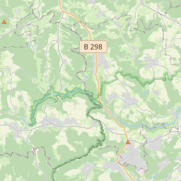
| Coverage | Polygon |
| Centre Point | 48.8401316,9.90721362513035 |
| OSM | relation 3529309 |
| Computed Postcode | |
| Address Tags | |
| Extra Tags |
| Local name | Type | OSM | Address rank | Admin level | Distance | |
| Schönhardt | place:hamlet | relation 3529309 | 16 | 0 | details > | |
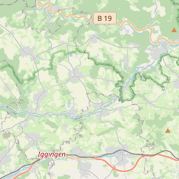
| Iggingen | place:village | relation 915434 | 16 | 8 | 0 | details > |
| Verwaltungsverband Leintal-Frickenhofer Höhe | boundary:administrative | relation 2953197 | 14 | 7 | 0 | details > |
| Ostalbkreis | place:county | relation 62708 | 12 | 6 | 0 | details > |
| Regierungsbezirk Stuttgart | boundary:administrative | relation 22041 | 10 | 5 | 0 | details > |
| Baden-Württemberg | place:state | relation 62611 | 8 | 4 | 0 | details > |
| Deutschland | place:country | relation 51477 | 4 | 2 | ~3 m | details > |
| de | place:country_code | 4 | 0 | |||
Parent Of | ||||||
Residential | ||||||
| Feuerseeweg | highway:residential | way 31646033 | 26 | ~137 m | details > | |
| Feuerseeweg | highway:residential | way 214615038 | 26 | ~159 m | details > | |
| Mulfinger Straße | highway:residential | way 242036427 | 26 | ~181 m | details > | |
| Mulfinger Straße | highway:residential | way 242036424 | 26 | ~212 m | details > | |
| Mulfinger Straße | highway:residential | way 31646032 | 26 | ~169 m | details > | |
| Rosengäßle | highway:residential | way 32637091 | 26 | ~212 m | details > | |
| Unterböbinger Straße | highway:residential | way 262716811 | 26 | ~369 m | details > | |
| Unterböbinger Straße | highway:residential | way 30004841 | 26 | ~13 m | details > | |
Unclassified | ||||||
| No Name | highway:unclassified | way 263388768 | 26 | ~182 m | details > | |
| No Name | highway:unclassified | way 264092749 | 26 | ~264 m | details > | |
| No Name | highway:unclassified | way 263388766 | 26 | ~248 m | details > | |
| No Name | highway:unclassified | way 31645959 | 26 | ~398 m | details > | |