| Name | Farnewinkel (name)
|
| Type | boundary:administrative |
| Last Updated | 2018-12-03 18:38 |
| Admin Level | 10 |
| Rank | Suburb |
| Importance | 0.25 (estimated) |
| Coverage | Polygon |
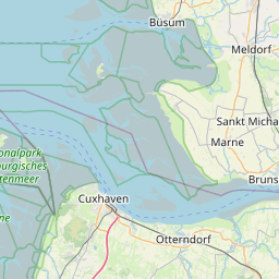
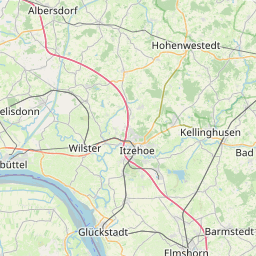
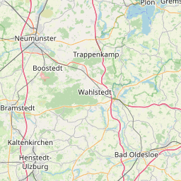
| Centre Point | 54.0792488,9.1441651 |
| OSM | relation 3518675 |
| Computed Postcode | |
| Address Tags | |
| Extra Tags | hamlet (place)
|
| Local name | Type | OSM | Address rank | Admin level | Distance | |
| Farnewinkel | boundary:administrative | relation 3518675 | 20 | 10 | 0 | details > |
| Nindorf | place:village | relation 420611 | 16 | 8 | 0 | details > |
| Mitteldithmarschen | boundary:administrative | relation 403810 | 14 | 7 | 0 | details > |
| Dithmarschen | place:county | relation 27028 | 12 | 6 | 0 | details > |
| Schleswig-Holstein | place:state | relation 51529 | 8 | 4 | 0 | details > |
| Deutschland | place:country | relation 51477 | 4 | 2 | ~3 m | details > |
| de | place:country_code | 4 | 0 | |||
Linked Places | ||||||
| Farnewinkel | place:hamlet | node 284436560 | 16 | 0 | details > | |
Parent Of | ||||||
Grass | ||||||
| Ausbildungsplatz SV OG Farnewinkel | landuse:grass | way 130274219 | 0 | ~872 m | details > | |
Industrial | ||||||
| Bürgersolarpark Nindorf/Farnewinkel | landuse:industrial | way 123458656 | 22 | ~403 m | details > | |
Unclassified | ||||||
| Alte Dorfstraße | highway:unclassified | way 130274217 | 26 | ~42 m | details > | |
| Alte Dorfstraße | highway:unclassified | way 130274218 | 26 | ~151 m | details > | |
| No Name | highway:unclassified | way 62694673 | 26 | ~592 m | details > | |
Residential | ||||||
| Dornenkrugsweg | highway:residential | way 101011769 | 26 | ~213 m | details > | |
| Leeweg | highway:residential | way 130274223 | 26 | ~131 m | details > | |
| Ostweg | highway:residential | way 101011759 | 26 | ~85 m | details > | |
| Pommernwinkel | highway:residential | way 113560101 | 26 | ~447 m | details > | |
| Schulstraße | highway:residential | way 130274225 | 26 | ~87 m | details > | |
| Schulstraße | highway:residential | way 130274224 | 26 | ~43 m | details > | |
| Süderlandweg | highway:residential | way 291282153 | 26 | ~277 m | details > | |
| Süderlandweg | highway:residential | way 378655629 | 26 | ~486 m | details > | |
| No Name | highway:residential | way 130274230 | 26 | ~63 m | details > | |
Secondary | ||||||
| Farnewinkler Straße | highway:secondary | way 130274220 | 26 | ~215 m | details > | |
| Farnewinkler Straße | highway:secondary | way 130274221 | 26 | ~800 m | details > | |
| Farnewinkler Straße | highway:secondary | way 122655441 | 26 | ~277 m | details > | |
| Farnewinkler Straße | highway:secondary | way 131391291 | 26 | ~336 m | details > | |
| Farnewinkler Straße | highway:secondary | way 131391290 | 26 | ~185 m | details > | |
| L 327 | highway:secondary | way 131391295 | 26 | ~981 m | details > | |
Track | ||||||
| Süderlandweg | highway:track | way 113560103 | 26 | ~599 m | details > | |
Rest_area | ||||||
| No Name | highway:rest_area | way 131391318 | 26 | ~606 m | details > | |
| No Name | highway:rest_area | way 44019127 | 26 | ~483 m | details > | |
Service | ||||||
| Schulstraße | highway:service | way 131391302 | 27 | ~27 m | details > | |