| Name | Zum Oberland (name)
|
| Type | highway:residential |
| Last Updated | 2018-12-04 11:48 |
| Admin Level | 15 |
| Rank | Street / Major Landmark |
| Importance | 0.1 (estimated) |
| Coverage | Point |
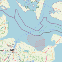
| Centre Point | 54.3737151,10.1546135 |
| OSM | way 4015611 |
| Computed Postcode | 24159 |
| Address Tags | |
| Extra Tags | designated (foot)
private (motor_vehicle)
asphalt (surface)
5 (width)
|
| Local name | Type | OSM | Address rank | Admin level | Distance | |
| Zum Oberland | highway:residential | way 4015611 | 26 | 0 | details > | |
| Holtenau | place:suburb | node 2173126000 | 20 | 0 | details > | |
| Kiel | place:city | node 24487450 | 16 | 0 | details > | |
| Blücherplatz | place:municipality | node 71564862 | 16 | 0 | details > | |
| Knoop | place:hamlet | node 275034674 | 16 | 0 | details > | |
| Hof Heisch | place:hamlet | node 427658760 | 16 | 0 | details > | |
| Lehmkaten | place:hamlet | node 4442860223 | 16 | 0 | details > | |
| Stift | place:village | node 292283878 | 16 | 0 | details > | |
| Dorf Pries | place:village | node 2379857203 | 16 | 0 | details > | |
| Kiel | place:county | relation 27021 | 12 | 6 | 0 | details > |
| Schleswig-Holstein | place:state | relation 51529 | 8 | 4 | 0 | details > |
| 24159 | place:postcode | 5 | 0 | |||
| 24159 | place:postcode | relation 1204009 | 5 | 0 | details > | |
| Deutschland | place:country | relation 51477 | 4 | 2 | ~3 m | details > |
| de | place:country_code | 4 | 0 | |||
Parent Of | ||||||
Building | ||||||
| Offiziersheim | historic:building | way 95603040 | 30 | ~271 m | details > | |
Taxiway | ||||||
| Taxiway E | aeroway:taxiway | way 82284698 | 30 | ~461 m | details > | |
| No Name | aeroway:taxiway | way 28411248 | 30 | ~485 m | details > | |
| No Name | aeroway:taxiway | way 82284701 | 30 | ~433 m | details > | |
Bench | ||||||
| No Name | amenity:bench | node 3235151698 | 30 | ~343 m | details > | |
| No Name | amenity:bench | node 3235151701 | 30 | ~367 m | details > | |
| No Name | amenity:bench | node 3235151700 | 30 | ~362 m | details > | |
| No Name | amenity:bench | node 3235151699 | 30 | ~356 m | details > | |
Bunker | ||||||
| No Name | military:bunker | way 93935664 | 30 | ~139 m | details > | |
Pier | ||||||
| No Name | man_made:pier | way 93935656 | 30 | ~234 m | details > | |
| No Name | man_made:pier | way 486713834 | 30 | ~317 m | details > | |
| No Name | man_made:pier | way 486713835 | 30 | ~312 m | details > | |
Apron | ||||||
| No Name | aeroway:apron | way 28435130 | 30 | ~371 m | details > | |
Waste_basket | ||||||
| No Name | amenity:waste_basket | node 5941220169 | 30 | ~123 m | details > | |
Slipway | ||||||
| No Name | leisure:slipway | node 430709576 | 30 | ~445 m | details > | |
| No Name | leisure:slipway | node 1108554283 | 30 | ~313 m | details > | |