| Name | Ganghoferstraße (name)
|
| Type | highway:residential |
| Last Updated | 2018-12-04 08:02 |
| Admin Level | 15 |
| Rank | Street / Major Landmark |
| Importance | 0.1 (estimated) |
| Coverage | Point |
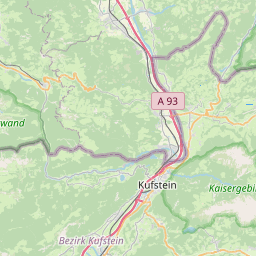
| Centre Point | 47.6550448,12.1640538 |
| OSM | way 11145174 |
| Computed Postcode | 83080 |
| Address Tags | |
| Extra Tags | 50 (maxspeed)
asphalt (surface)
|
| Local name | Type | OSM | Address rank | Admin level | Distance | |
| Ganghoferstraße | highway:residential | way 11145174 | 26 | 0 | details > | |
| Oberaudorf | place:village | relation 2186930 | 16 | 8 | 0 | details > |
| Agg | place:hamlet | node 390542929 | 16 | 0 | details > | |
| Lechen | place:hamlet | node 1578376745 | 16 | 0 | details > | |
| Moosen | place:hamlet | node 1583587002 | 16 | 0 | details > | |
| Schindlberg | place:hamlet | node 1573020942 | 16 | 0 | details > | |
| Hoffeld | place:hamlet | node 1607715768 | 16 | 0 | details > | |
| Auerbach | place:hamlet | node 1583587025 | 16 | 0 | details > | |
| Behamgrub | place:hamlet | node 1573021568 | 16 | 0 | details > | |
| Wechselberg | place:hamlet | node 1578376866 | 16 | 0 | details > | |
| Niederaudorf | place:hamlet | node 282832369 | 16 | 0 | details > | |
| Kleinberg | place:hamlet | node 1578376915 | 16 | 0 | details > | |
| Zaglach | place:hamlet | node 1573021668 | 16 | 0 | details > | |
| Grub | place:hamlet | node 1578376878 | 16 | 0 | details > | |
| Thal | place:hamlet | node 1578560814 | 16 | 0 | details > | |
| Erlenau | place:hamlet | node 1270662072 | 16 | 0 | details > | |
| Mühlbach | place:hamlet | node 1587383767 | 16 | 0 | details > | |
| Zimmerau | place:hamlet | node 1578376732 | 16 | 0 | details > | |
| Innsiedlung | place:hamlet | node 1270661528 | 16 | 0 | details > | |
| Watschöd | place:hamlet | node 1583900906 | 16 | 0 | details > | |
| Eder | place:hamlet | node 1092295264 | 16 | 0 | details > | |
| Gfallermühle | place:hamlet | node 1580725128 | 16 | 0 | details > | |
| Ramsau | place:hamlet | node 1092167146 | 16 | 0 | details > | |
| Reisach | place:hamlet | node 282832370 | 16 | 0 | details > | |
| Trißl | place:hamlet | node 1579871013 | 16 | 0 | details > | |
| Landkreis Rosenheim | place:county | relation 2156362 | 12 | 6 | 0 | details > |
| Obb | boundary:administrative | relation 2145274 | 10 | 5 | 0 | details > |
| Bayern | place:state | relation 2145268 | 8 | 4 | ~1 m | details > |
| 83080 | place:postcode | 5 | 0 | |||
| 83080 | place:postcode | relation 1114580 | 5 | 0 | details > | |
| Deutschland | place:country | relation 51477 | 4 | 2 | ~4 m | details > |
| de | place:country_code | 4 | 0 | |||
Parent Of | ||||||
Building | ||||||
| No Name | building:yes | way 499363338 | 30 | ~110 m | details > | |
| No Name | building:yes | way 111656657 | 30 | ~166 m | details > | |
| No Name | building:yes | way 111656579 | 30 | ~34 m | details > | |
| No Name | building:yes | way 111656593 | 30 | ~189 m | details > | |
| No Name | building:yes | way 111656596 | 30 | ~63 m | details > | |
| No Name | building:yes | way 499363341 | 30 | ~214 m | details > | |
| No Name | building:yes | way 111656590 | 30 | ~111 m | details > | |
| No Name | building:yes | way 499363345 | 30 | ~221 m | details > | |
| No Name | building:yes | way 111656608 | 30 | ~136 m | details > | |
| No Name | building:yes | way 499363348 | 30 | ~227 m | details > | |
| No Name | building:yes | way 111656617 | 30 | ~100 m | details > | |
| No Name | building:yes | way 111656566 | 30 | ~132 m | details > | |
| No Name | building:yes | way 111656534 | 30 | ~234 m | details > | |
| No Name | building:yes | way 111656574 | 30 | ~202 m | details > | |
| No Name | building:yes | way 499363351 | 30 | ~192 m | details > | |
| No Name | building:yes | way 499363355 | 30 | ~247 m | details > | |
| No Name | building:yes | way 111656644 | 30 | ~230 m | details > | |
| No Name | building:yes | way 111656653 | 30 | ~69 m | details > | |
| No Name | building:yes | way 111656544 | 30 | ~41 m | details > | |
| No Name | building:yes | way 111656643 | 30 | ~13 m | details > | |
| No Name | building:yes | way 111656582 | 30 | ~98 m | details > | |
| No Name | building:yes | way 111656659 | 30 | ~33 m | details > | |
| No Name | building:yes | way 111656651 | 30 | ~16 m | details > | |
| No Name | building:yes | way 111656554 | 30 | ~75 m | details > | |
| No Name | building:yes | way 111656581 | 30 | ~43 m | details > | |
| No Name | building:yes | way 499363376 | 30 | ~118 m | details > | |