| Name | Amrumring (name)
|
| Type | highway:residential |
| Last Updated | 2018-12-04 11:47 |
| Admin Level | 15 |
| Rank | Street / Major Landmark |
| Importance | 0.1 (estimated) |
| Coverage | Point |
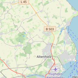
| Centre Point | 54.3578407,10.0807921 |
| OSM | way 11798760 |
| Computed Postcode | 24107 |
| Address Tags | |
| Extra Tags | 30 (maxspeed)
|
| Local name | Type | OSM | Address rank | Admin level | Distance | |
| Amrumring | highway:residential | way 11798760 | 26 | 0 | details > | |
| Suchsdorf | place:suburb | node 71571361 | 20 | 0 | details > | |
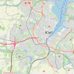
| Kiel | place:city | node 24487450 | 16 | 0 | details > | |
| Levensau | place:hamlet | node 4001152437 | 16 | 0 | details > | |
| Gut Knoop | place:hamlet | node 275038037 | 16 | 0 | details > | |
| Knoop | place:hamlet | node 275034674 | 16 | 0 | details > | |
| Altwittenbek | place:village | node 293448837 | 16 | 0 | details > | |
| Langenhorst | place:hamlet | node 472629976 | 16 | 0 | details > | |
| Felmerholz | place:village | node 297759264 | 16 | 0 | details > | |
| Kleinfelmerholz | place:hamlet | node 4469987719 | 16 | 0 | details > | |
| Rögen | place:hamlet | node 4469991989 | 16 | 0 | details > | |
| Friedrichshof | place:hamlet | node 2152177161 | 16 | 0 | details > | |
| Gut Projensdorf | place:hamlet | node 568251953 | 16 | 0 | details > | |
| Kopperpahl | place:hamlet | node 276864187 | 16 | 0 | details > | |
| Kiel | place:county | relation 27021 | 12 | 6 | 0 | details > |
| Schleswig-Holstein | place:state | relation 51529 | 8 | 4 | 0 | details > |
| 24107 | place:postcode | 5 | 0 | |||
| 24107 | place:postcode | relation 1206204 | 5 | 0 | details > | |
| Deutschland | place:country | relation 51477 | 4 | 2 | ~3 m | details > |
| de | place:country_code | 4 | 0 | |||
Parent Of | ||||||
Kindergarten | ||||||
| Städtische Kindertagesstätte Suchsdorf | amenity:kindergarten | way 317587060 | 30 | ~23 m | details > | |
Building | ||||||
| No Name | building:yes | way 253674957 | 30 | ~23 m | details > | |
| No Name | building:yes | way 253674959 | 30 | ~7 m | details > | |
| No Name | building:yes | way 151796701 | 30 | ~33 m | details > | |
| No Name | building:yes | way 253683443 | 30 | ~24 m | details > | |
| No Name | building:yes | way 253683445 | 30 | ~38 m | details > | |
| No Name | building:yes | way 253683448 | 30 | ~53 m | details > | |
| No Name | building:yes | way 253683451 | 30 | ~68 m | details > | |
| No Name | building:yes | way 253674963 | 30 | ~40 m | details > | |
Parking | ||||||
| No Name | amenity:parking | way 31776892 | 30 | ~11 m | details > | |
Track | ||||||
| No Name | leisure:track | way 63881282 | 30 | ~114 m | details > | |