| Name | Mittlerer Graben (name)
Mittlerer Graben (name:de)
St 2057 (ref)
|
| Type | highway:secondary |
| Last Updated | 2018-12-04 11:03 |
| Admin Level | 15 |
| Rank | Street / Major Landmark |
| Importance | 0.1 (estimated) |
| Coverage | Point |
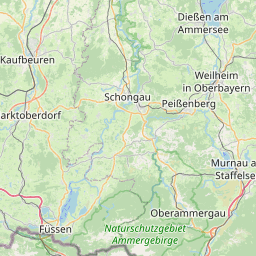
| Centre Point | 47.8404461,11.1435094 |
| OSM | way 12118392 |
| Computed Postcode | 82362 |
| Address Tags | 82362 (postcode)
|
| Extra Tags | 50 (maxspeed)
asphalt (surface)
|
| Local name | Type | OSM | Address rank | Admin level | Distance | |
| Mittlerer Graben | highway:secondary | way 12118392 | 26 | 0 | details > | |
| Weilheim | place:town | way 298065054 | 16 | 0 | details > | |
| Weilheim in Oberbayern | place:town | relation 936925 | 16 | 8 | 0 | details > |
| Landkreis Weilheim-Schongau | boundary:administrative | relation 62600 | 12 | 6 | 0 | details > |
| Obb | boundary:administrative | relation 2145274 | 10 | 5 | 0 | details > |
| Bayern | place:state | relation 2145268 | 8 | 4 | ~1 m | details > |
| 82362 | place:postcode | 5 | 0 | |||
| 82362 | place:postcode | relation 1108181 | 5 | 0 | details > | |
| Deutschland | place:country | relation 51477 | 4 | 2 | ~4 m | details > |
| de | place:country_code | 4 | 0 | |||
Parent Of | ||||||
Social_facility | ||||||
| Brücke Oberland e.V. Jugend- und Familienhilfen | amenity:social_facility | way 159356450 | 30 | ~28 m | details > | |
Bus_stop | ||||||
| Mittlerer Graben, Weilheim i. OB | highway:bus_stop | node 4742529962 | 30 | ~34 m | details > | |
| Mittlerer Graben, Weilheim i. OB | highway:bus_stop | node 385205392 | 30 | ~31 m | details > | |
Place_of_worship | ||||||
| Stiftskirche Heilig Geist | amenity:place_of_worship | way 158023861 | 30 | ~76 m | details > | |
School | ||||||
| Volkshochschule Weilheim | amenity:school | way 159356376 | 30 | ~52 m | details > | |
Restaurant | ||||||
| Zum Neuner | amenity:restaurant | way 158241790 | 30 | ~11 m | details > | |
Building | ||||||
| No Name | building:yes | way 159356246 | 30 | ~73 m | details > | |
| No Name | building:yes | way 159356531 | 30 | ~87 m | details > | |
| No Name | building:yes | way 254637139 | 30 | ~9 m | details > | |
| No Name | building:yes | way 254640834 | 30 | ~60 m | details > | |
| No Name | building:yes | way 158241791 | 30 | ~23 m | details > | |
Parking | ||||||
| No Name | amenity:parking | way 255532328 | 30 | ~62 m | details > | |
| No Name | amenity:parking | way 255532327 | 30 | ~80 m | details > | |