| Name | Raiffeisenstraße (name)
|
| Type | highway:unclassified |
| Last Updated | 2018-12-04 08:02 |
| Admin Level | 15 |
| Rank | Street / Major Landmark |
| Importance | 0.1 (estimated) |
| Coverage | Point |
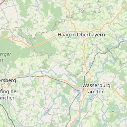
| Centre Point | 48.2201205,12.133087 |
| OSM | way 15221201 |
| Computed Postcode | 84427 |
| Address Tags | |
| Extra Tags |
| Local name | Type | OSM | Address rank | Admin level | Distance | |
| Raiffeisenstraße | highway:unclassified | way 15221201 | 26 | 0 | details > | |
| Haberstätt | place:isolated_dwelling | node 1686098880 | 20 | 0 | details > | |
| Weinthal | place:isolated_dwelling | node 1686099031 | 20 | 0 | details > | |
| Sankt Wolfgang | place:village | relation 934757 | 16 | 8 | 0 | details > |
| Gumpenstätt | place:hamlet | node 2330984068 | 16 | 0 | details > | |
| Gumpenstätt | place:hamlet | node 2330984067 | 16 | 0 | details > | |
| Reisern | place:hamlet | node 1686098185 | 16 | 0 | details > | |
| Giglberg | place:hamlet | node 1686098207 | 16 | 0 | details > | |
| Landkreis Erding | boundary:administrative | relation 62356 | 12 | 6 | 0 | details > |
| Obb | boundary:administrative | relation 2145274 | 10 | 5 | 0 | details > |
| Bayern | place:state | relation 2145268 | 8 | 4 | ~1 m | details > |
| 84427 | place:postcode | 5 | 0 | |||
| 84427 | place:postcode | relation 1114041 | 5 | 0 | details > | |
| Deutschland | place:country | relation 51477 | 4 | 2 | ~4 m | details > |
| de | place:country_code | 4 | 0 | |||
Parent Of | ||||||
Fire_station | ||||||
| Freiwillige Feuerwehr St. Wolfgang | amenity:fire_station | node 1988815508 | 30 | ~56 m | details > | |
Hairdresser | ||||||
| Schön Sylvia | shop:hairdresser | node 510352997 | 30 | ~109 m | details > | |
Recycling | ||||||
| No Name | amenity:recycling | node 540270509 | 30 | ~95 m | details > | |
Playground | ||||||
| No Name | leisure:playground | way 15221198 | 30 | ~115 m | details > | |