| Name | Teichweg (name)
|
| Type | highway:residential |
| Last Updated | 2018-12-04 14:13 |
| Admin Level | 15 |
| Rank | Street / Major Landmark |
| Importance | 0.1 (estimated) |
| Coverage | Point |
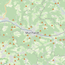
| Centre Point | 48.9090117,9.5798669 |
| OSM | way 23736687 |
| Computed Postcode | 71566 |
| Address Tags | |
| Extra Tags | 30 (maxspeed)
|
| Local name | Type | OSM | Address rank | Admin level | Distance | |
| Teichweg | highway:residential | way 23736687 | 26 | 0 | details > | |
| Strümpfelhof | place:isolated_dwelling | node 5491834388 | 20 | 0 | details > | |
| Kellerklinghöfle | place:isolated_dwelling | node 5470474803 | 20 | 0 | details > | |
| Althütte | place:village | relation 400938 | 16 | 8 | 0 | details > |
| Vereinbarte Verwaltungsgemeinschaft der Stadt Backnang | boundary:administrative | relation 1613874 | 14 | 7 | 0 | details > |
| Rems-Murr-Kreis | place:county | relation 62412 | 12 | 6 | 0 | details > |
| Regierungsbezirk Stuttgart | boundary:administrative | relation 22041 | 10 | 5 | 0 | details > |
| Baden-Württemberg | place:state | relation 62611 | 8 | 4 | 0 | details > |
| 71566 | place:postcode | 5 | 0 | |||
| 71566 | place:postcode | relation 3377943 | 5 | 0 | details > | |
| Deutschland | place:country | relation 51477 | 4 | 2 | ~3 m | details > |
| de | place:country_code | 4 | 0 | |||
Parent Of | ||||||
Building | ||||||
| No Name | building:yes | way 190031588 | 30 | ~42 m | details > | |
| No Name | building:yes | way 190031438 | 30 | ~17 m | details > | |
| No Name | building:yes | way 190031392 | 30 | ~10 m | details > | |
| No Name | building:yes | way 321108633 | 30 | ~25 m | details > | |
| No Name | building:yes | way 321108648 | 30 | ~9 m | details > | |
| No Name | building:yes | way 190031437 | 30 | ~29 m | details > | |
| No Name | building:yes | way 190031590 | 30 | ~27 m | details > | |